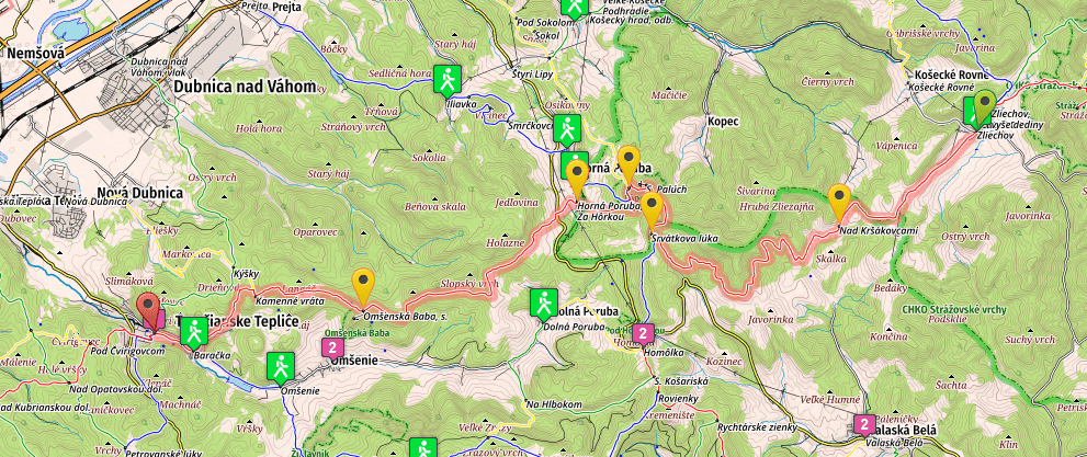
* You will find the previous stages on the following page: SNP Trail, Stages 11-15.
Disclaimer: Some links on this website may be affiliate links. That means that when you click them and make a purchase (for example booking some accommodation along the trail on Booking.com), I may earn a small commission, at no extra cost to you whatsoever. This small income helps me to keep this website running, paying for hosting and domain renewal, and also to keep answering the questions of fellow long-distance hikers by email that keep coming regularly, week after week. Thank you :).
Table of Contents
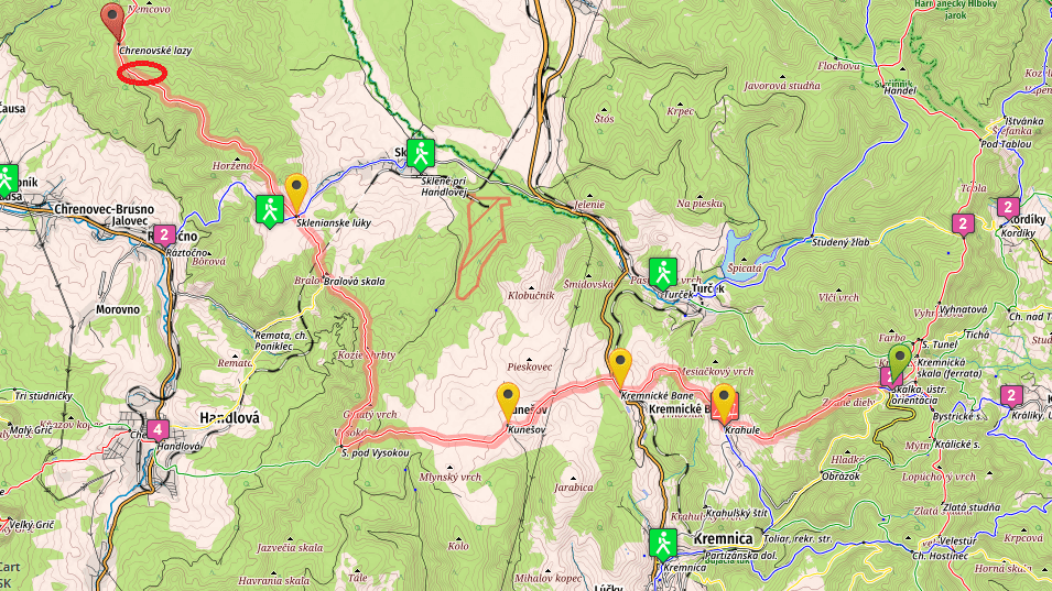
Stage 16, From Kráľova Srtudňa hotel to Skalka (mountain resort)

- Distance: 26 kilometers
- Total Ascend/Descend: 1130 meters/1200 meters
- Technical difficulty: 3/5
- Orientation Difficulty: 2/5
- Terrain/Asphalt: 95%/5%
- Refreshment posts/Springs: Except of the starting point (Kralova Studna hotel) there are no real refreshment posts/springs on today’s hike. Take at least two or three liters of water with you from the hotel, so you don’t end up dehydrated once you finally reach Skalka recreational center.
- Km 26, Skalka, recreational center, plenty of accommodation options (check accommodation page for list and prices), wellness, restaurants.
- GPS File: Stage 16, Kralova Studna – Skalka
Brief Description: You will start a day with a relaxing mild descent on a wide gravel road, which lasts for no less than ten kilometers. You will reach pass Maly Sturec (km 10, 890m), one of the most important road passes in Slovakia. Interestingly enough, expect of a small parking area you won’t find here any services.
Once you cross the road and start climbing on the other side, the character of the path changes completely. You will spend a lot of energy maneuvering over countless mall ascends and descends, sometimes on a technical terrain, after finally climbing (very steeply) to Flochova pass (km 15.5, 1300m).
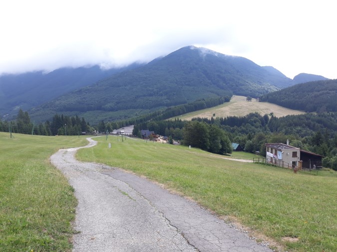
From Flochova pass, the terrain alters one more time. Firstly you will navigate a narrow trail in the midst of dwarf pines, going mostly downhill, for about one kilometer. Then the trail widens, and you’ll follow mostly well maintained paths (used in winter for cross country skiing) all the way to Skalka recreational center, where you will find accommodation, restaurants & buffets, and wellness center.
Stage 17, From Skalka to Jalovske Lazy (camping site with water)
- Distance: 28 kilometers
- Total Ascend/Descend: 790 meters/1200 meters
- Technical difficulty: 2/5
- Orientation Difficulty: 5/5
- Terrain/Asphalt: 75%/25%
- Refreshment posts/Springs:
- Km 4.6, Krahule, restaurants, grocery store, accommodation (you’ll need to leave the red marks and walk about 500 meters to the center of the village, following blue marks to your left, to reach the center with grocery store and most accommodation options).
- Km 7, Spring “Center of Europe”, N48.74305° E18.9141°, fresh water spring near a monastery, in a nice peaceful location. When the season is dry, you won’t find any water in the spring, but you can ask some from the nuns living in the monastery.
- Km 11.5, Kunešov, small tavern, open only in the afternoon, grocery store. You can also ask locals for water.
- Km 15.5, “Bear Spring”, N48.7284° E18.82337°, fresh water spring with a nice sitting area, you’ll always find water here.
- Km 28, Unofficial camping site “Jalovské Lazy”, fresh water spring, camping place. The way to the spring isn’t marked, the easiest way to find it is asking one of the locals for help. However, except of Saturday and Sunday you often won’t meet anyone here (there are no permanent residents, people just have their huts). You can find two springs in the area. The one which we found while walking the trail is located on the very end of the meadow, below one of the last huts on your left hand. Follow a narrow footpath that descends to the forest, and after about fifty meters you’ll find the spring. The GPS location of the spring: N48.79725° E18.76509°.
- GPS File: Stage 17, Skalka – Jalovské Lazy
Brief Description: You start descending along an indistinct ridge, taking some twist and turns. The red marks aren’t really obvious (we actually didn’t find them above Krahule). If you want to follow the trail your best bet is to walk with the GPS. But even if you do not have the GPS, you can’t really get lost, since you’ll see the ski slopes that run down from the hill all the way to the center of Krahule (km 4.6)…
In Krahule you can buy basic groceries in a small shop, or refresh yourself in one of the restaurants. Remember that this is primarily a ski resort, and the village isn’t very busy in summer. But you will find something open and you can always stay in “Penzion Stred Europy“. This place has such a huge capacity that it can never be packed during summer months.
Leaving Krahule, you’ll walk six kilometers on asphalt (the road isn’t particularly busy but you’ll meet some cars), passing the Symbolic center of Europe (km 7, spring), eventually arriving in Kunesov (km 11.5, tavern, grocery store).
From Kunesov you’ll walk across a long stretch of fields and grass. You won’t find many trees to paint red marks on, and the navigation can be tricky during summer months. Walking with GPS here is your best bet again.
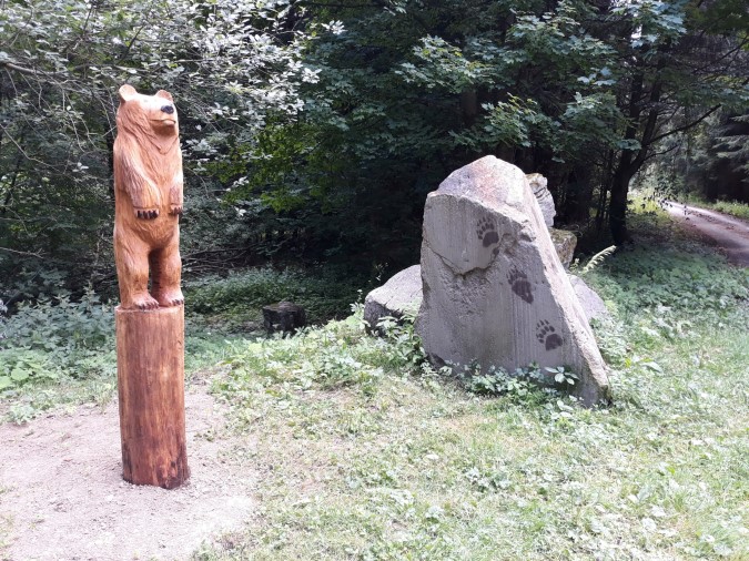
Eventually you’ll enter the forest and come to “Bear Spring” (km 15.5, abundant spring and a small shelter), where you’ll likely see your first brown bear on your hike (a wooden statue :)).
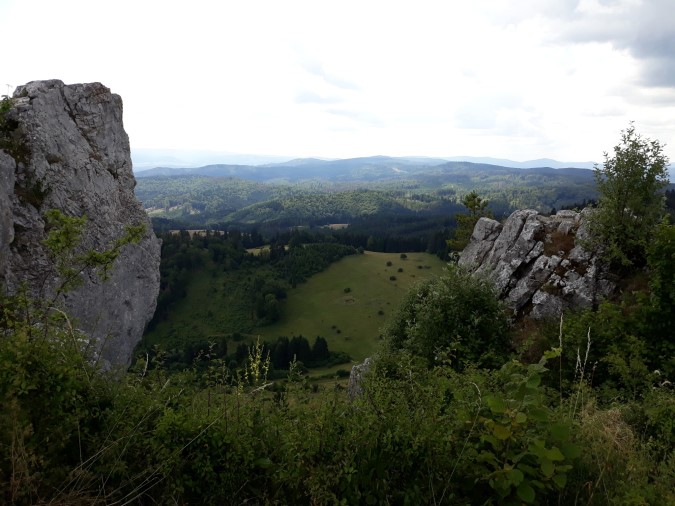
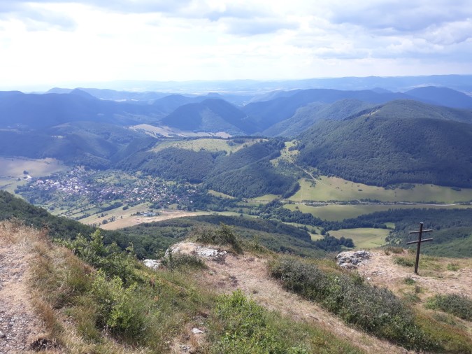
You’ll then climb steeply to Vysoká, and several small ascends and descends will take you to Bralová Skala (km 20, 826m), where you can relax in the sun and enjoy the views.
One longer descent and one longer ascend (marks aren’t very obvious here) followed by a nice walk on a wide road over a small ridge will eventually take you to Jalovské Lazy, a camping place where you’ll find water spring (see refreshment posts above).


Stage 18, From Jalovské Lazy to Fačkovské Sedlo (ski resort)
- Distance: 33.5 kilometers
- Total Ascend/Descend: 1500 meters/1450 meters
- Technical difficulty: 3/5
- Orientation Difficulty: 4/5
- Terrain/Asphalt: 98%/2%
- Refreshment posts/Springs:
- Km 10.5, Fresh water spring “Za Žiarmi”, N48.863° E18.70253°, near to a hunting hut on your right. Nice sitting area nearby the spring.
- Km 20, Spring “Hadviga”, N48.91987° E18.70075°, watch on your right hand, very close to the trail, you shouldn’t miss this spring with wonderful fresh water.
- Km 28, Spring “Pod Vraňou Skalou”, N48.95549° E18.67286°, copious spring right on the trail.
- Km 33.5, Ski resort Fačkovské Sedlo, restaurant, accommodation.
- GPS File: Stage 18, Jalovske Lazy – Fackovske Sedlo
Brief Description: You should start as early as possible, as a very tough day awaits you. Switching between wide trail, narrow footpath and gravel road, going up and down many times, you’ll eventually emerge in front of a hunting hut near Žiare (on your right, km 10.5, spring).
After a short intermezzo to Čertova Dolina (km 11.5), you’ll start one of the steepest climbs on the entire SNP Trail, crawling up to Vyšehrad (km 12.5), an ancient fortress (not visible anymore, but you can see how it looked like, studying the information tables on the top of the mountain) and also a natural reserve with some endemic species of flowers.
This is a wonderful vantage point and you can see many mountains you’ve passed on your way along E8 Path in Slovakia, and also some mountains that still way for you in front.
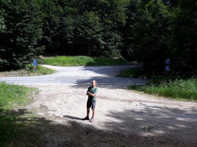
A very steep descent brings you to a road crossing at “Vyšehradské sedlo” pass (km 14.5, 575m). Next four kilometers to Hadviga (km 18.5, 675m) don’t look difficult on the map, but they are far from easy, with constant uphills and downhills, and marks that are far from obvious. Be sure to fill your water bottles at a spring that you’ll find shortly after passing Hadviga, on your right hand.
You’ll follow another ridge with minimum tourists, with some steep climbs to Gaštan (838m) and Závozy (912m) peaks, before finally descending to Vrícke sedlo (km 25), another road crossing, where you’ll find no facilities.
As it typically happens when you descend to a saddle, you’ll start climbing again. You’ll cover almost three hundred vertical meters before reaching Baran peak, and after a short descend and ascend Vrania Skala (km 28), with an obvious spring directly on the trail.
From here it’s finally downhill, all the way to Fackovske Sedlo, where good food and comfortable bed wait for tired hikers.
Stage 19, from Fačkovské Sedlo to Zliechov
- Distance: 20 kilometers
- Total Ascend/Descend: 1070 meters/1270 meters
- Technical difficulty: 3/5
- Orientation Difficulty: 3/5
- Terrain/Asphalt: 80%/20%
- Refreshment posts/Springs:
- Km 9, Fresh water spring “Pod Javorinkou”, N48.95006° E18.53698°, on your right.
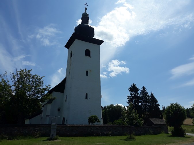
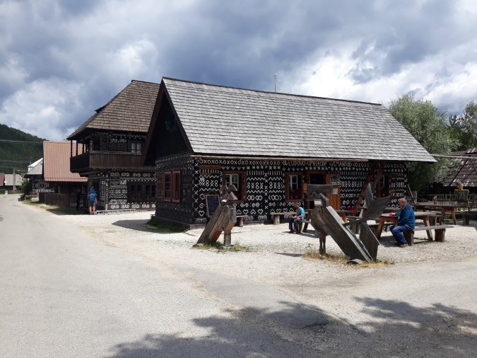
- Km 11, Čičmany village, accommodation and restaurants, famous for folk architecture.
- Km 17, Spring “Sedlo pod Strážovom”, N48.95927° E18.46388°, if you can’t find this particular spring do not worry, you will pass two other springs on your way to Zliechov.
- Km 20, Zliechov, accommodation in a tourist hostel, grocery stores, taverns, simple restaurant.
- GPS File: Stage 19, Fackovske Sedlo – Zliechov
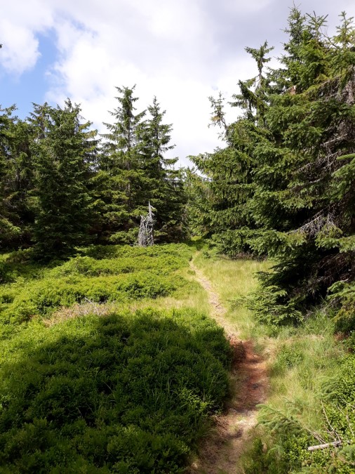
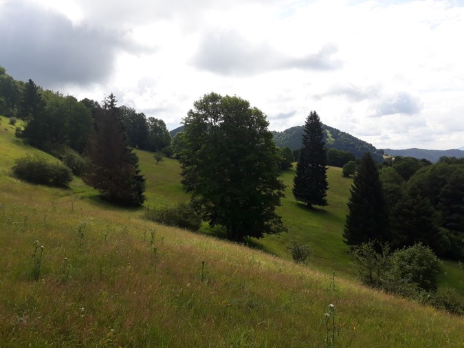
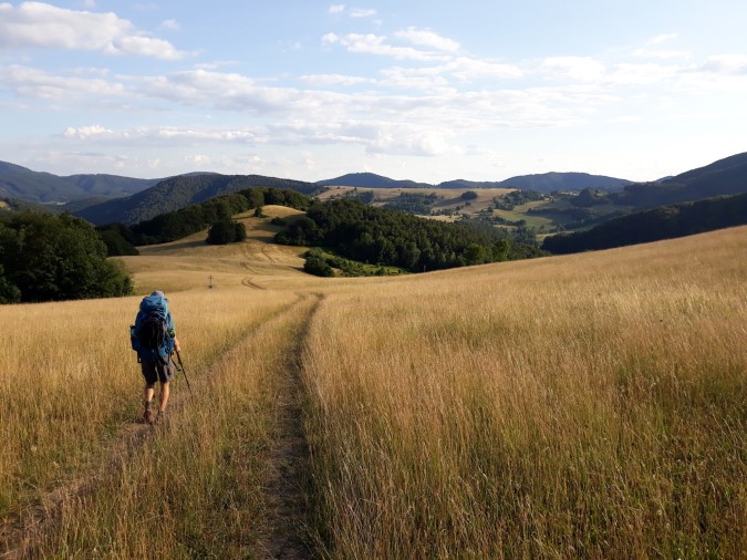
Brief Description: You’ll start with a steep climb, traversing a ski slope up to Homôlka peak (km 1,5, 1073m). From Homolka you’ll continue following a wild and not always obvious path, along another side ridge of Strážov mountains, crossing many beautiful meadows and forests along the way.
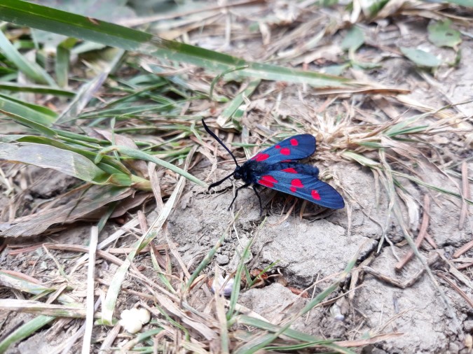
It’s common to see herds of deer up here, and if you are lucky enough (or unlucky, depends on your perspective), you can even spot brown bear somewhere in the distance. Eventually, after crossing several less-known peaks, you’ll descent to Čičmany, a village famous for folk architecture, where you can eat and sleep.
Many foreigners visit Cicmany, and you won’t have problems getting around with English.
You’ll start climbing again, continually at first, following a paved and later a gravel road, before switching to a narrow and steep footpath that will take you all the way up to the highest point of Strážov mountains, the peak Strážov (km 16, 1213m). You’ll actually have to make small detour to the top of the peak (10 minutes), but it’s worth the effort. The way to the top is well marked.
From Strážov it is all downhill, steep at first and gradual later. You will pass several springs on your way, before finally arriving in Zliechov (603m), where you can shop, eat, and sleep. Check accommodation page for information about the tourist hostel in Zliechov or the options in Cicmany.
Stage 20, From Zliechov to Trenčianske Teplice
- Distance: 32 kilometers
- Total Ascend/Descend: 1400 meters/1720 meters
- Technical difficulty: 2/5
- Orientation Difficulty: 4/5
- Terrain/Asphalt: 97%/3%
- Refreshment posts/Springs:
- Km 7, Lapošovci settlement, water tap N48.92864° E18.37874°, you’ll need to make a hundred meter detour from red marks, climbing up to your right.
- Km 16, Fresh water spring “Nad Hornou Porubou”, N48.93433° E18.32241°, on your right hand, right on the trail, you should not miss it.
- Km 18, Horná Poruba, taverns, grocery store, possibility of accommodation in a guest house. You’ll need to depart the trail once crossing the main road in the village, turning right (going down). Following the main street you’ll find both taverns and grocery store.
- Km 26, Fresh water spring “Pod Omšenskou Babou”, N48.91512° E18.23542°, visible from the trail on your right hand, you’ll find a nice shelter on your left hand, below the trail and spring, where you can sleep, covered under the roof.
- Km 32, Trenčianske Teplice, spa town, all services, check accommodation options here.
- GPS File: Stage 20, from Zliechov to Trencianske Teplice
Brief Description: After a relatively easy hike yesterday you have a tough day in front of you. Very early start is recommended, not only becasue of the difficulty of the trail but also becasue you’ll end your walk in a lovely spa town Trenčianske Teplice. It’s nice to arrive early and enjoy some procedures, hydro-massage, or just a friendly vibe of a small spa city…
You’ll start your walk from Zliechov following all kinds of wide trails, gravel, mud, grass, traversing various meadows and small settlements on your way to Srvátková Lúka camping site (km 13, no services). The marks aren’t always obvious, so be careful with the navigation.
From Srvátková Lúka you’ll climb to one of the most beautiful peaks on the entire trail, Vápeč (km 15, 955m). You can enjoy views in all directions from the top. Some people like to bivouac near the top of the mountain (there is a nice grassy spot), enjoying the sunrise the following morning.
Steep downhill will take you to Horná Poruba, where you can buy groceries, have a beer, or even sleep in a private accommodation (check this section for more information).
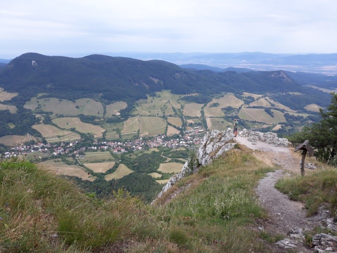
From Horná Poruba the trails winds up and down, passing several water springs and rocky peaks (Omšenská Baba, km 25, is the best one, but you’ll need to make a 10 minute detour to reach the peak).
Few small climbs and a final descent will take you to Trenčianske Teplice, a famous spa town, where you will find plenty of places to rest, ranging from affordable B&B and guest houses to four star hotels, and all services.
If you want to make a rest day, Teplice is an ideal spot to refresh both your body and mind. Just ask the locals for a good wellness/hot water pool in the city. There are many of them…
For the last seven stages of SNP trail (Trail of the Heroes of Slovak National Uprising, E8 Path in Slovakia), please continue here: SNP Trail, stages 21-27
* For the previous five stages (from Telgart to Kralova Studna), please go here: SNP Trail Part 3.