* You will find the previous stages on the following page: SNP Trail, Stages 6-10.
Disclaimer: Some links on this website may be affiliate links. That means that when you click them and make a purchase (for example booking some accommodation along the trail on Booking.com), I may earn a small commission, at no extra cost to you whatsoever. This small income helps me to keep this website running, paying for hosting and domain renewal, and also to keep answering the questions of fellow long-distance hikers by email that keep coming regularly, week after week. Thank you :).
Table of Contents
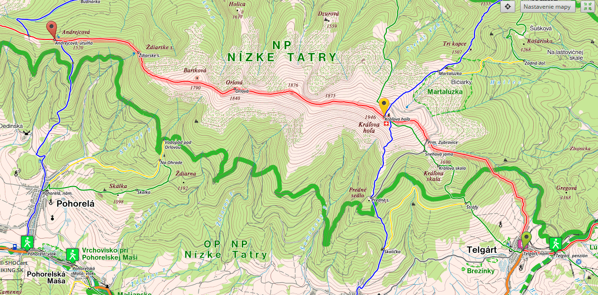
Stage 11, From Telgart to Andrejcová shelter
- Distance: 16.2 kilometers
- Total Ascend/Descend: 1250 meters/730 meters
- Technical difficulty: 3/5
- Orientation Difficulty: 1/5
- Terrain/Asphalt: 95%/5%
- Refreshment posts/Springs:
- Km 5, “Prameň Zubrovice”, fresh water spring, N48.87641° E20.1557°
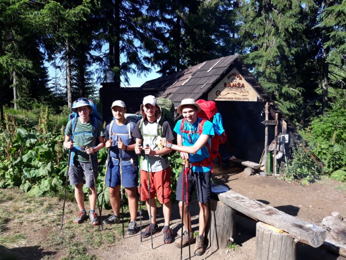
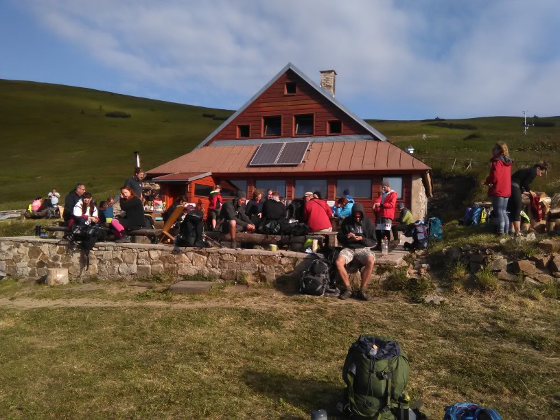
- Km 16, Andrejcová shelter – Food options, beer, fresh water spring, you can sleep in the shelter or camp outside of the shelter.
- GPS File: Stage 11 – Telgart – Andrejcova
Brief Description: This is your first day of a four-day long traverse of Low Tatra mountains, which many considere the most beautiful part of the entire SNP Trail.
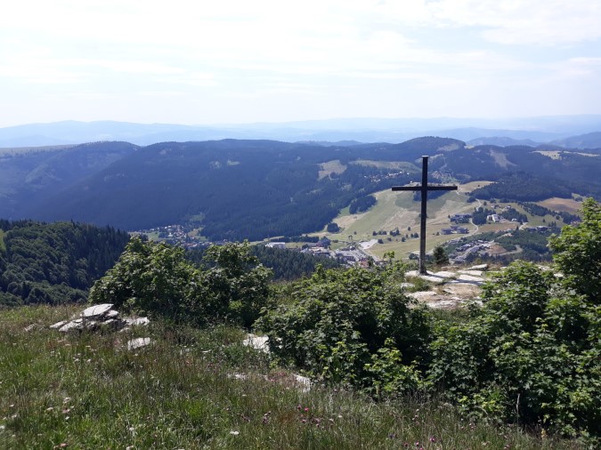
Leaving Telgart you’ll start a steep ascend all the way to Kralova Hola (km 6.5, 1946m), passing fresh water spring “Prameň Zubrovice” on your way, which is the only strong spring on today’s hike.
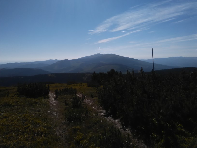
After Kráľova Hoľa you’ll follow a beautiful scenic path along the main right of Low Tatra mountains, going up and down and enjoying amazing views (or a thick fog, depends on the day). Eventually you’ll descend to Andrejcova shelter (1410m), where you can sleep either inside (you need your own sleeping bag) or camp outside (if you have a tent).
Andrejcova is a well-managed shelter, you’ll get food and drinks and will definitely meet some nice people up there…
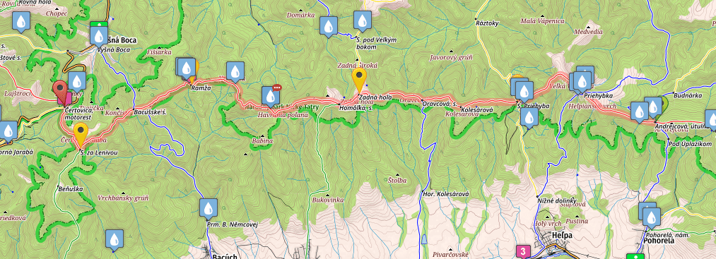
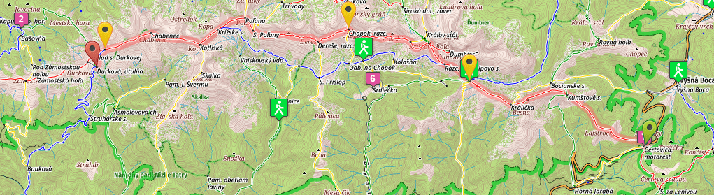
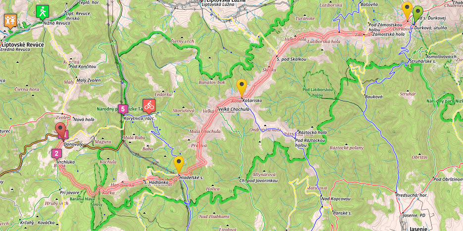
Stage 12, Andrejcová shelter – Čertovica pass
- Distance: 28 kilometers
- Total Ascend/Descend: 1380 meters/1560 meters
- Technical difficulty: 4/5
- Orientation Difficulty: 2/5
- Terrain/Asphalt: 99%/1%
- Refreshment posts/Springs:
- Km 6.3, “Priehyba pass”, fresh water spring, N48.90681° E19.95848°, little bit off the trail, walk 10 meters down the asphalt road on your left, then turn left again on the first gravel road. After following it for about 250 meters you’ll reach a spring. Some people prefer to filter water from this particular spring, but we drank it and experienced no difficulties.
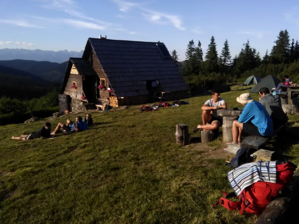
- Km 20, Ramža shelter – Fresh water spring, N48.91419° E19.79448°, (follow the marks), wooden shelter, no food options. This is a more punk-like shelter. While well maintained for sleep, you won’t find anyone running the place, serving food and drinks. The shelter is typically used be people who try to cross Low Tatra mountains in three days, while in this guide we do a crossing in four days (avoiding sleeping at Ramža)
- Km 28, Čertovica pass, accommodation options, restaurant.
- GPS File: Stage 12 – Andrejcova – Certovica
Brief Description: After a relatively easy stage no. eleven, a tough day in the mountains awaits you between Anrejcova and Certovica. Starting a day with a steep climb to Velka Vapenica (1691m) you’ll drop 500 vertical meters on mere 2.5 kilometers, on a technical descend to Priehyba pass (km 6.3, 1190m, spring). Many hikers feel their knees after struggling through this section.
Things won’t get easier though. A strenuous climb to Kolesarova (km 8.6, 1508m) is followed with many small ups and down, until you finally reach Ramža shelter (km 20, 1267m), where you can rest a bit and enjoy tasty fresh water from local spring. Watch the marks carefully while approaching Ramza. Many hikers (including us) miss a peculiar turn right from a wide road to a narrow footpath among the dwarf-pines, about 1km before Ramža.
After Ramža several shorter ascends and descends test your morale, until you finally arrive in Čertovica pass, where a well deserved bed and tasty food awaits in one of the B&B establishments.
Stage 13, From Čertovica to Ďurková shelter
- Distance: 25.6 kilometers
- Total Ascend/Descend: 1670 meters/1280 meters
- Technical difficulty: 2/5
- Orientation Difficulty: 1/5
- Terrain/Asphalt: 100%/0%
- Refreshment posts/Springs:
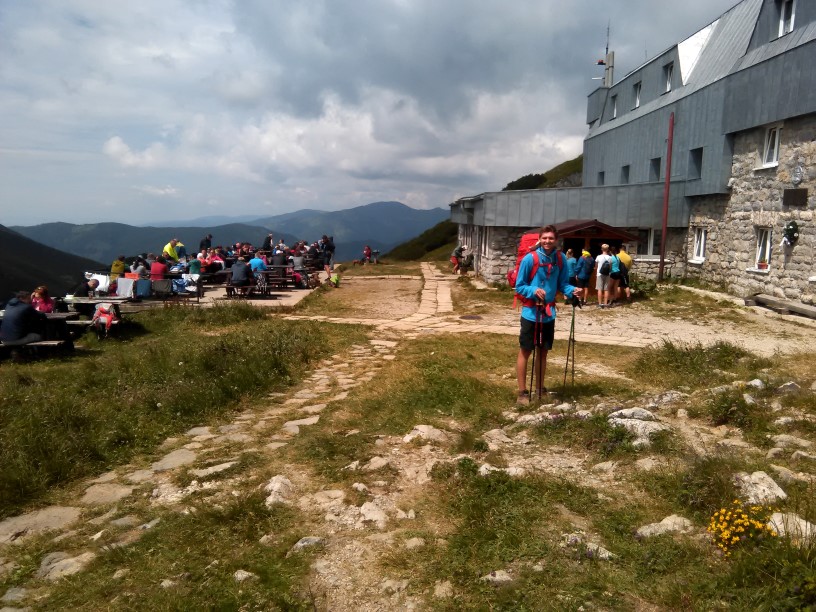
- Km 8.3, “Chata M.R. Štefánika“, mountain hut, one of the most famous mountain huts in Slovakia, plenty of food options, water spring, accommodation (open all year long, book in advance in summer months if you want to secure a bed).
- Km 14, Chopok peak (2024m) – The most industrialized peak in Slovakia happens to be the highest point on SNP Trail (unless you make a short detour to Ďumbier from Krúpovo pass), you’ll find bars and restaurants in the area, as well as accommodation, most of them heavily overpriced…
- Km 25.6, Ďurková shelter, a well-maintained shelter hut with a spring nearby. You can get food and drinks here during the summer. The place doesn’t have such a good vibe as Andrejcova shelter, and tends to get overcrowded on weekends, but it’s the only real option to sleep inside, on this part of the ridge.
- GPS File: Stage thirteen, Certovica – Durkova
Brief Description: Crossing the Certovica pass, you enter the western part of Low Tatra mountains, which is much more touristic than the eastern part (from Telgart to Certovica).
The trails are obvious, maintained, and well-trodden, and during this day (especially around Chopok peak) you will probably meet more hikers than you have met on all the other days of your hike combined so far.
The day is difficult and long, every descend followed by yet another ascend. But the views, chamois, marmot, and other species specific for high altitudes, that you can spot relatively easily on today’s walk, as well as two huts where you can eat and drink whatever you like (M.R. Sterfanik hut and Kamenna Hut), and plenty of hikers you’ll greet as the day drags on (check the language school page to learn how to greet people in Slovak language), will make it a pleasant experience.
You will have to depart the trail to reach Durkova shelter, following blue marks. The shelter is visible on your left below the ridge, and unless walking in a thick fog it can’t really be missed…
Stage 14, From Ďurková shelter to Donovaly
- Distance: 27.7 kilometers
- Total Ascend/Descend: 1150 meters/1790 meters
- Technical difficulty: 4/5
- Orientation Difficulty: 1/5
- Terrain/Asphalt: 90%/10%
- Refreshment posts/Springs:
- Km 18, Hiadeľské Sedlo, fresh water spring, N48.86125° E19.30529° (follow marks), shelter where you can spend the night (without any services)
- Km 22.5, “Útulňa pod Kečkou” shelter + fresh water spring nearby. In summer months you can get beer and also some food in the shelter.
- Km 27.7, Donovaly, all services, plenty of accommodation options.
- GPS File: Stage fourteen, Durkova – Donovaly.
Brief Description: Today you’ll finish the crossing of Low Tatra mountains. Leaving Ďurková shelter, you can either retrace your steps and return to the red marks, or you can take a shortcut and join the SNP trail a bit further ahead.
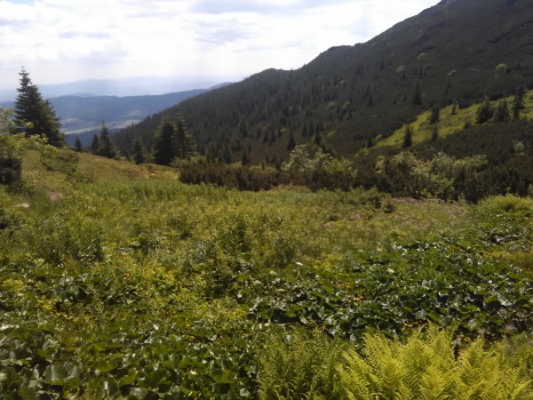
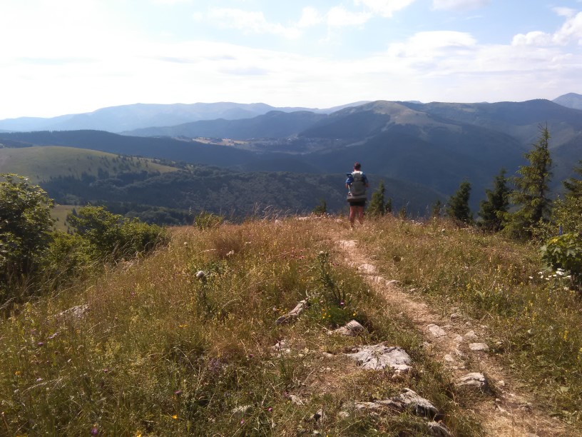
Crossing several peaks of altitude of 1,500 m and more (Latiborska Hola, Skalka, Kosarisko, Velka Chochula) you’ll eventually reach Prašivá (1652m) from where you’ll start a technical, rocky and long descend to Hiadeľské Sedlo (km 18, 1102m, spring). You can rest here in a nice shelter, or continue a bit further, climbing steeply to Kozý Chrbát (1330 m), a national nature reserve, where you can spot beautiful flowers and creatures inhabiting local meadows.
A little bit further and you’ll reach a small pass bellow Kečka peak, where you can refresh yourself in a relatively newly opened shelter (they typically have beer and also some food).
Two kilometers later you’ll emerge on a paved road in a small mountain village Buly. Continuing for two more kilometers, you’ll finally arrive in the center of Donovaly, where you’ll find all services and plenty of accommodation options.
You have just finished a difficult crossing of Low Tatra mountains. Have a good beer in a local brewery and relax a bit, before embarking on the second half of your journey :).
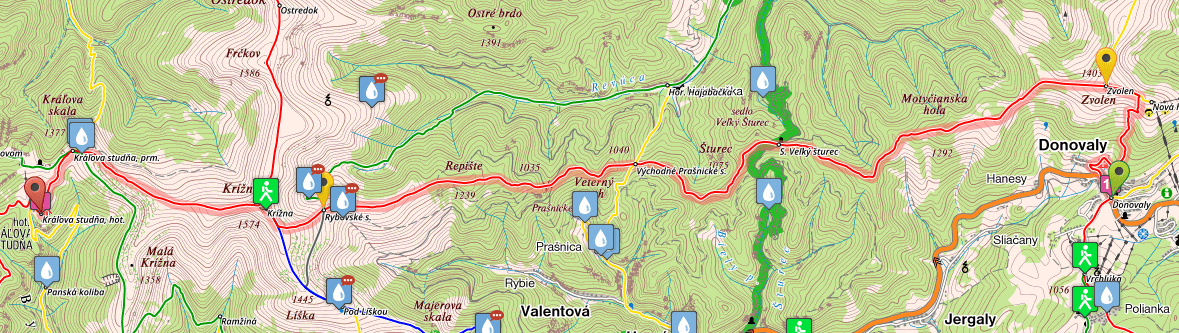
Stage 15, From Donovaly to Kráľova Studňa Hotel
- Distance: 20.4 kilometers
- Total Ascend/Descend: 1440 meters/1150 meters
- Technical difficulty: 3/5
- Orientation Difficulty: 4/5
- Terrain/Asphalt: 90%/10%
- Refreshment posts/Springs:
- Km 19, Kráľova Studňa spring, N48.88355° E19.04663° right on the trail, you’ll find here water all year long.
- Km 20.4, Kráľova Studňa Hotel – Recently renovated, you can get a room and meals. The food quality isn’t the best but it’s your only option for food and a bed on this section of the SNP (E8) trail.
- GPS File: Stage 15, Donovaly – Kralova Studna
Brief Description: I hope you rested well in Donovaly, becasue you’ll need all your forces for a climb to Zvolen (km 2.8, 1403m), which is one of the steepest climbs on the entire 780km of SNP trail.
After Zvolen you’ll walk through countless small uphills and downhills, crossing both meadows and forest, after you finally arrive to Východné Prašnícke Sedlo km 10.5, 920m), the lowest point on today’s hike. The way is definitely more difficult as it seems from the map, since the elevation profile does not show countless small descents and ascends (+10m, -10m, +15m, -10m etc).
From “Prašnícke Sedlo” pass you’ll climb–steeply at first and gradually later, all the way to Krížna (km 17, 1574m), a beautiful peak in Veľká Fatra mountain range.
Be extremely careful with the trail marks on Krížna, since red marks go in two directions from the top of the mountain. You should follow the trail to your left, where signpost shows “Kráľova Studňa”.
Going down you’ll reach the spring Kráľova Studňa and a little bit later the hotel, bearing the same name…
For the next five stages of SNP trail (Trail of the Heroes of Slovak National Uprising, E8 Path in Slovakia), please continue here: SNP Trail, stages 16-20
* For the previous five stages (from Kysak to Telgart), please go here: SNP Trail Part 2.