I divided the trail to 27 shorter stages, for the purpose of making simple maps and descriptions of each day on the trail, GPS, and information on springs and refreshment points.
However, there are many more accommodation/camping options on the path, and you do not necessarily need to follow this itinerary. Choose the pace that suits you, and enjoy the trails in Slovakia.
All maps are credit to mapy.denikn.sk
Disclaimer: Some links on this website are affiliate links. That means that when you click them and make a purchase (for example booking some accommodation along the trail on Booking.com), I may earn a small commission, at no extra cost to you whatsoever. This small income helps me to keep this website running, paying for hosting and domain renewal, and also to keep answering the questions of fellow long-distance hikers by email that keep coming regularly, week after week. Thank you :).
Table of Contents
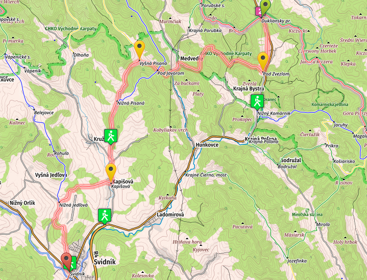
Stage no 1: From Dukelský Priesmyk (Dukla Pass) to Svidník
(click the link for online map)
- Distance: 26.4 kilometers
- Total Ascend/Descend: 530 meters/790 meters
- Technical difficulty: 2/5
- Orientation Difficulty: 3/5
- Terrain/Asphalt: 60%/40%
- Refreshment posts/Springs:
- Km 10, Medvedie, Restaurant Penzíon Medveď, open in summer from 1pm to 8pm
- Km 18, “Death Valley”, fresh water spring, N49.36082° E21.59481°
- Km 19, Kapišová, tavern
- Km 22: Nižná Jedlová, tavern, spring, N49.33441° E21.56109°
- Km 26.4, Svidník, taverns, bars, restaurants, shops (check Accommodation page for information on accommodation-camping options on all stages)
- GPS File: Stage one, Dukla – Svidnik
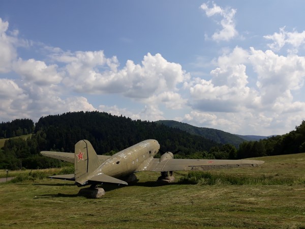
Brief Description: You will start with a short walk on a main road (plenty of cars passing from Poland to Slovakia and in the opposite direction), before changing for a more pleasant country road, walking past the airplanes and tanks from the second world war.
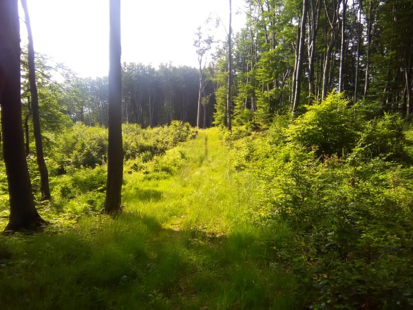
A nice, quiet and often muddy forest follows for about 7km, before you eventually arrive in Medvedie (km 10, be careful about the marks here, one turn to the right can easily be missed, right before Medvedie).
After crossing a small hill you’ll arrive in Vyšná Písaná, and you’ll spend next 7km on the road, passing the “Valley of Death“ and eventually arriving in Kapišová (km 19), a nice small village with a tavern. You’ll cross another pass and emerge in Nižná Jedlová (km 26), another village with tavern and spring. Four up-and-down kilometers remain to Svidník, combination of forest paths and small roads, passing a great camping place and shelter along the way. In Svidník you’ll find all services.
Stage no.2: From Svidník to Zborov
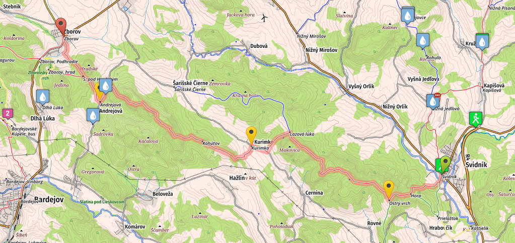
- Distance: 29 kilometers
- Total Ascend/Descend: 1300 meters/1220 meters
- Technical difficulty: 2/5
- Orientation Difficulty: 2/5
- Terrain/Asphalt: 90%/10%
- Refreshment posts/Springs:
- Km 14, Kurimnka, tavern, open only in the afternoon. You can ask locals for water if the tavern is closed
- Km 25, Andrejová, fresh water spring right next to the main road, on your left hand, N49.3415° E21.338°
- Km 29, Zborov, tavern, bar, grocery stores, guest house (check Accommodation page for information on accommodation-camping options on all stages)
- GPS File: Stage two, Svidnik – Zborov
Brief Description: After leaving Svidník you will start a steep ascend, followed by crossing a nice and peaceful non-touristic ridge, passing through Ostrý Vrch (599m), Čierna Hora (667m), and Široká Hora (573) and Makovica (655) before descending to Kurimka (km 14), where you will find a tavern.
Another ascend and another non-touristic ridge follows, before you eventually descend to Andrejová (km 25), where you will find a copious water spring, right next to the road. The last small ascend awaits you, before you’ll gradually descend down to a rural gypsy colony on the outskirts of Zborov. Shortly after passing this colony you’ll find yourself in the Center of Zborov, where you can stay in Guest house Jana.
Note: If you prefer to avoid passing the gypsy colony on the outskirts of Zborov village (I didn’t find it dangerous in any means–the locals are polite and won’t bother you unless you misbehave, but I understand that some people may prefer to skip it), you can do so by turning left in Sedlo pod Hradským, direction Castle Zborov, and then following yellow marks to Zborovské Podhradie, where you will join the red marks again, and can either return back to the center of Zborov (for food and accommodation), or continue in the Westward direction, avoiding visiting Zborov village.
Stage no 3: From Zborov to Žobrák
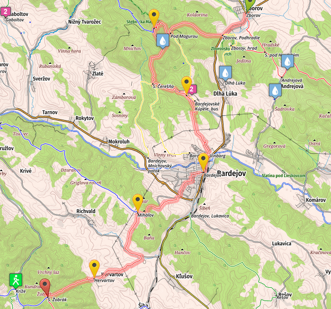
- Distance: 32.2 kilometers
- Total Ascend/Descend: 1600 meters/1025 meters
- Technical difficulty: 3/5
- Orientation Difficulty: 3/5
- Terrain/Asphalt: 50%/50%
- Refreshment posts/Springs:
- Km 8.6, Zbojnicka studnička, fresh water spring, close to the trail, watch for marks indicating spring, N49.35099° E21.25112°
- Km 13.5, Bardejovské Kúpele, spa town, multiple bars and restaurants, walk to the center of the village (to your left hand) to find the restaurants
- Km 18, Bardejov, bars, restaurants, accommodation options, all services (check Accommodation page for information on accommodation-camping options on all stages)
- Km 23, Miháľov, tavern
- Km 29, Hervatov, tavern (Ask for water here if you plan to sleep at Zobrak shelter, since there is no water spring at Zobrak)
- GPS File: Stage 3, Zborov – Zobrak
Brief Description: The satge starts with 2km walk on a very busy road, with plenty of trucks and cars. Once you finally leave the road you will start climbing to Stepnicka Magura (km 7.5, 899m).
The ascent is mild at first, but gradually steepens, and the last two kilometers are extremely steep. Ensure to watch the trail marks in the forest, since there are many small trails and paths. From Magura you will descend gradually to Bardejovské Kúpele, where you will find restaurants and bars. If tired, you can call it a day and stay in the spa…
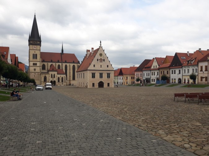
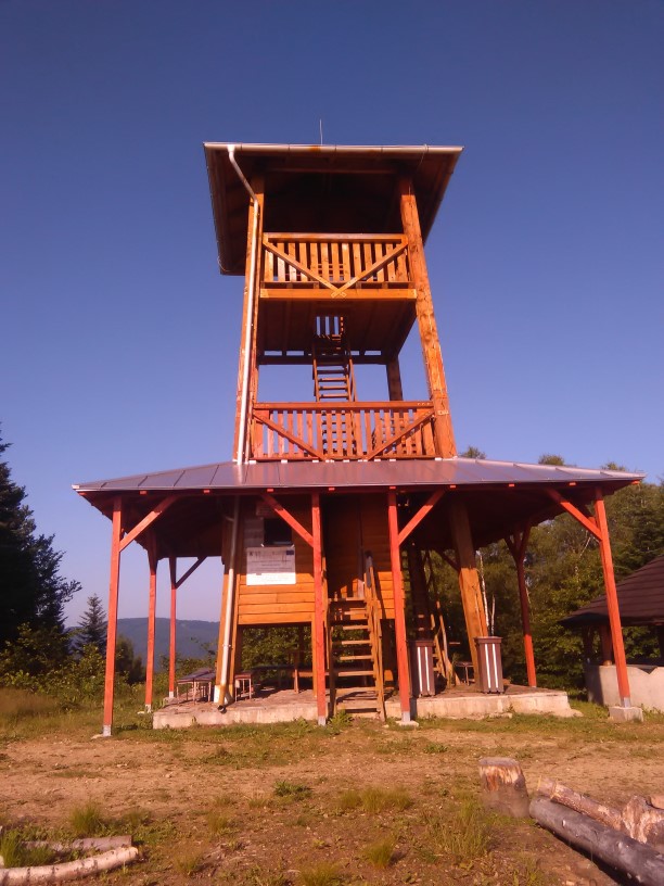
After climbing a small hill you’ll gradually descend to the historic center city of Bardejov., which is one of the UNESCO’s World Heritage sites. You can either stay in one of the local guest houses, or continue, walking mostly on the road, to Miháľov, Hervatov, and eventually ascending 500m on mere three kilometers, to the Zobrak shelter, where you can spend your night in a spacious shelter that can accommodate up to ten people (and is almost never full).
Stage four: From Žobrák to Veľký Šariš
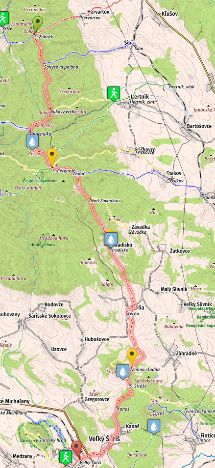
- Distance: 30 kilometers
- Total Ascend/Descend: 675 meters/1305 meters
- Technical difficulty: 2/5
- Orientation Difficulty: 2/5
- Terrain/Asphalt: 66%/33%
- Refreshment posts/Springs:
- Km 9.2, Chata Čergov (mountain hut), restaurant, open only on weekends
- Km 15, Hradisko, water pump in the center of the village (if you can not operate the pump, ask locals to help you, or to give you water), N49.13916° E21.22567°
- Km 19, Terňa, tavern, grocery stores
- Km 25, Kanaš, tavern
- Km 30, Veľký Šariš, restaurant & accommodation & wellness Šariš Park
- GPS File: Stage 4, Žobrák – Veľký Šariš
Brief Description: The day starts with a wonderful walk in the forests of Čergov mountains, small uphills and downhills, before you finally arrive at Čergov mountain hut (km 9), open only on weekends (if you are not lucky to find it open also during the week, which can happen sometimes in July and August). You will continue descending to a small village Hradisko (km 15), where you will find a water pump.
Then it’s mostly road walking (these roads aren’t busy though, and you won’t meet many cars, if any), through some small villages with taverns/shops, before you finally arrive to Veľký Šariš.
Stage 5: From Veľký Šariš to Kysak
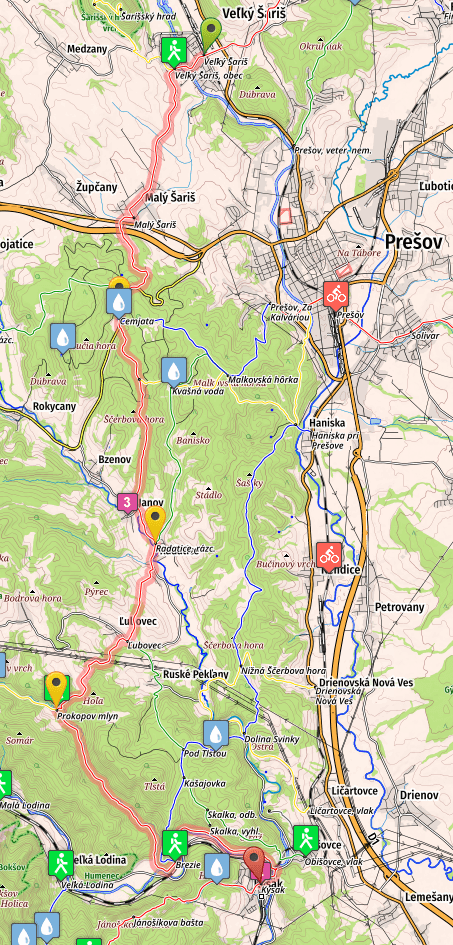
- Distance: 32.6 kilometers
- Total Ascend/Descend: 810meters/830 meters
- Technical difficulty: 2/5
- Orientation Difficulty: 3/5
- Terrain/Asphalt: 45%/55%
- Refreshment posts/Springs:
- Km 8, Cemjata, tavern and mineral water spring, N48.98283° E21.1746°
- Km 14.5, Radactice, taverns and grocery store
- Km 17, Ľubovec, tavern, slight detour from the trail, ask locals
- Km 29, Kysak, Brezie, possible accomodation, tavern (open only occasionally)
- Km 32 – Kysak, bars, grocery stores, possible accommodation.
- GPS File: Stage 5, V. Saris – Kysak
Brief Description: The stage starts with a dull road walk to Maly Šariš. After passing through a tunnel below the the speedway, and following a wide path you’ll eventually arrive to Cemjata (km 8), where you will find a tavern and a mineral spring. It is possible to camp here, check the Accommodation page for more information.
After walking in a rather thick forest for a few kilometers, you’ll arrive in Janov, and following a road shortly reach a village of Radatice (km 14.5). It’s the last refreshment point on the way to Kysak (unless you plan to make a small detour in Ľubovec), and it’s a good idea to stop here for a beer, water, and some groceries.
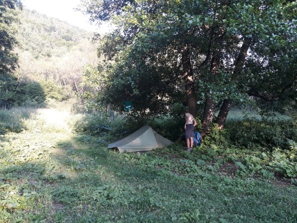
From Ľubovec you finally return to forests, and after a rather steep climb and a short descent you’ll reach a location knows as “Prokopov Mlyn“, or “Pustý Mlyn” (km 20), where you will find several abandoned houses in a desolate condition. You can camp nearby, or even try sleeping in one of the houses (if you are not afraid of ghosts :)).
After Prokopov Mlyn you’ll follow a pleasant paved forest road, eventually emerging in the valley near Kysak. From here you’ll again follow mostly paved roads (with some grassy sections, at some points difficult for orientation), passing a locality called Kysak – Brezie, where you can sleep both inside and outside (consult the staff onsite for options).
Finally, after few more kilometers following the river Hornád, you’ll arrive in Kysak, where you can find a shop, some bars and also a bed for the night…
For the next five stages of SNP trail (Trail of the Heroes of Slovak National Uprising, E8 Path in Slovakia), please continue here: SNP Trail, stages 6-10.