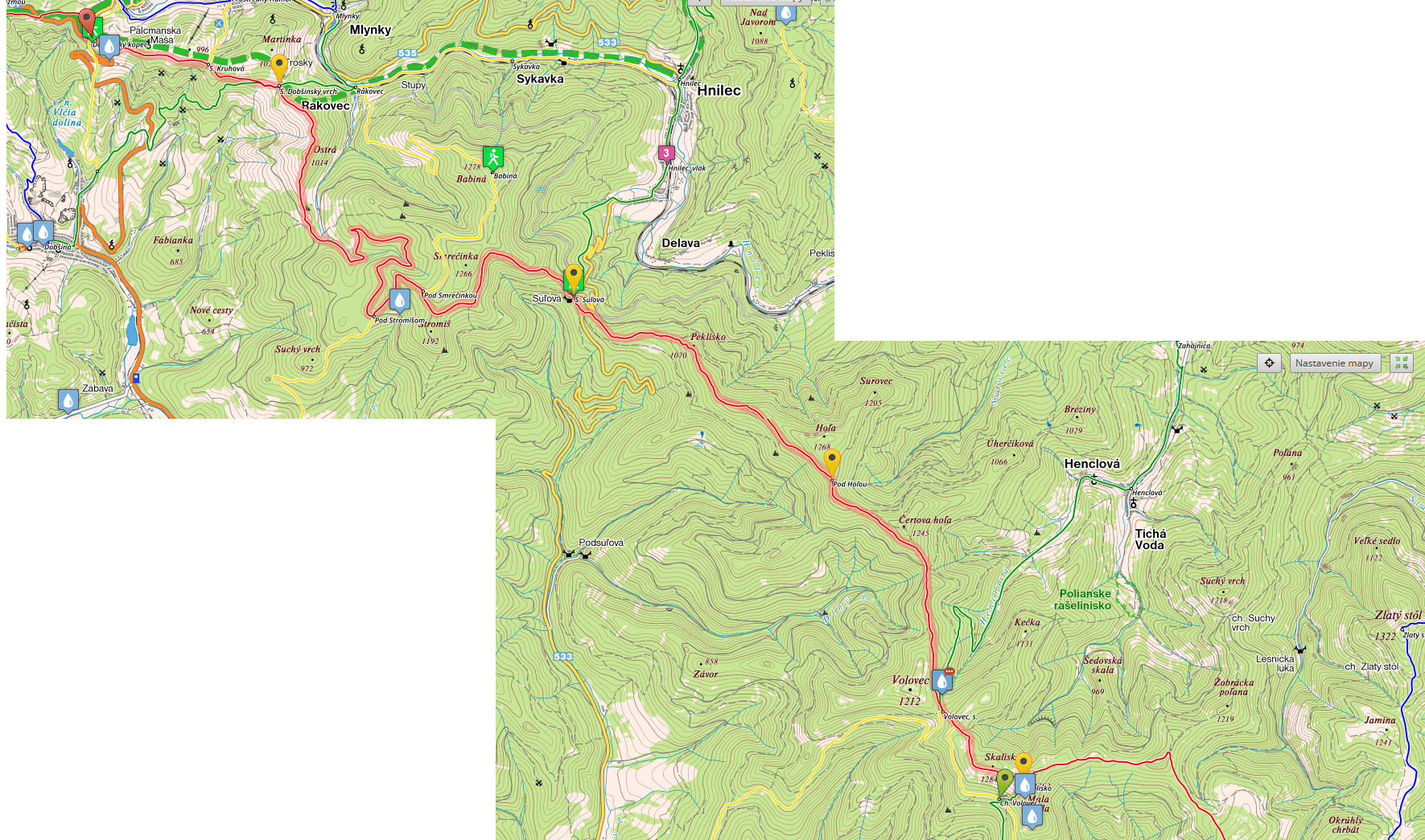
* For stages 1 to 5, please go here: Stages 1 to 5.
Disclaimer: Some links on this website may be affiliate links. That means that when you click them and make a purchase (for example booking some accommodation along the trail on Booking.com), I may earn a small commission, at no extra cost to you whatsoever. This small income helps me to keep this website running, paying for hosting and domain renewal, and also to keep answering the questions of fellow long-distance hikers by email that keep coming regularly, week after week. Thank you :).
Table of Contents
Stage 6 – from Kysak to Jahodná mountain hut
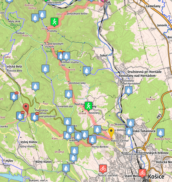
- Distance: 30.3 kilometers
- Total Ascend/Descend: 1260 meters/930 meters
- Technical difficulty: 2/5
- Orientation Difficulty: 2/5
- Terrain/Asphalt: 75%/25%
- Refreshment posts/Springs:
- Km 1.5, Marianka Spring, another mineral water spring, N48.85567° E21.20858°
- Km 11, Kráľova Studňa, fresh water spring, N48.80983° E21.179°, 800 meters detour from the way, follow blue marks,
- Km 17, Kavečany, tavern, one on the way, another 300 meters detour, ask locals for directions
- Km 21: Košice, Čermeľ, restaurant. You can leave the trail here and continue to the center of Kosice, the second biggest city in Slovakia, where you will find all facilities, plenty of accommodation options ranging from cheap hostels to luxury hotels, and can get basically whatever you may need.
- Km 25, Bankov, hotel with restaurant
- Km 30, Jahodná mountain hut, open all year long.
- GPS File: Stage six, Kysak – Jahodná
Brief Description: Climbing from Kysak, you will soon reach a beautiful scenic point called Jánošíkova Bašta (km 4, 523m), from where you can see the Hornád valley and the part of the trail which you walked the day before, on your way to Kysak.
You will continue ascending, following a path in the forest as it winds through Čierna Hora mountains, eventually reaching an altitude over 800 meters, and from there you will gradually descend to Kavečany, where you can quench your thirst in a tavern.
Continuing your descend, you’ll eventually reach the suburbs of Košice, called Čermel (km 21). Here you can again eat/drink something, and you should also visit the nearest grocery store and buy some provisions (you won’t pass any grocery store on the following four days, unless you make a 6km detour to Smolnik)!
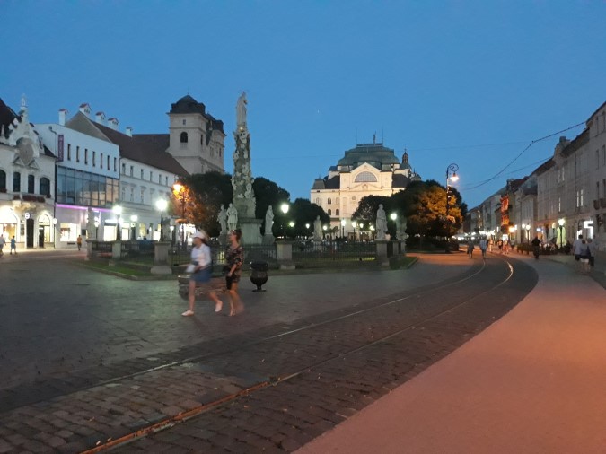
If you want to make a rest day, or enjoy a bit of Slovak city life, make a one day stop in Košice. More than 200,000 people live in Košice, and as you can imagine, you’ll find all services in the city. It’s busy both in the day and in the night..
Back to Čermel, you’ll follow a pleasant uphill, eventually reaching four star Hotel Bankov (km 25), where you can spend the night, or have a good (and expensive) meal. Five extra kilometers and you’ll reach Jahodná Hut (more affordable accommodation).
Stage 7 – from Jahodná mountain hut to Štós spa
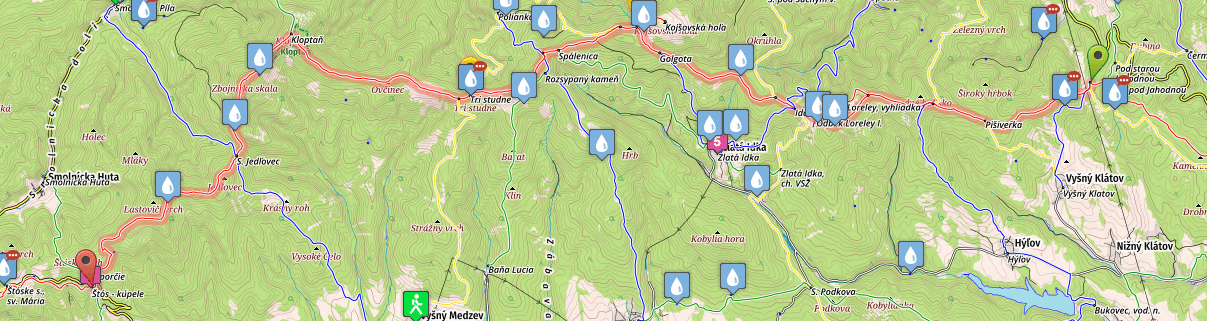
- Distance: 35.8 kilometers
- Total Ascend/Descend: 1625 meters/1565 meters
- Technical difficulty: 3/5
- Orientation Difficulty: 4/5
- Terrain/Asphalt: 98%/2%
- Refreshment posts/Springs:
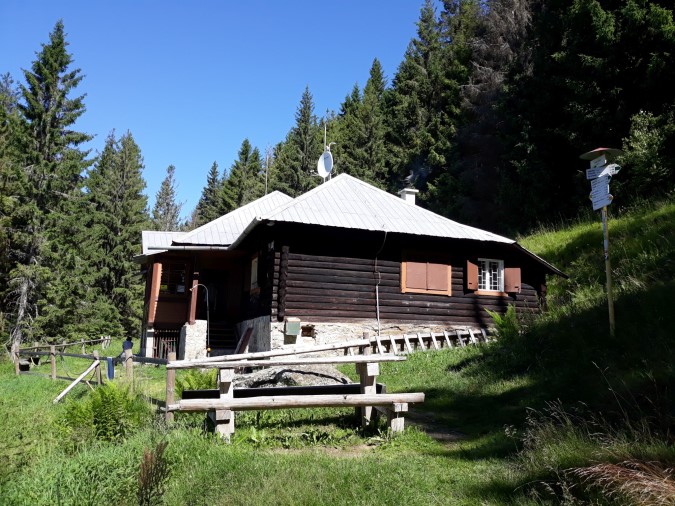
- Km 5, Mountain Hut Lajoška, restaurant with basic food options (accommodation also possible, in emergency needs) * 2021 update: the hut is in reconstruction, so do not count on any food or other services. You can still camp on the meadows nearby though.
- Km 15, Fresh water spring, N48.78007° E20.97997°, watch for a small wooden structure on your left hand while walking up to the Sedlo Kojšovská Hoľa. You need to open the cover of the structure to reach the delicious water behind.
- Km 16, Mountain Hut Erika, restaurant and accommodation options. Can be closed outside of June-August period.
- Km 21: Fresh water spring “Tri Studne”, N48.76544° E20.92055°, perfectly visible from the trail, abundant all year long.
- Km 30, Fresh water spring “Pod Lastovičím Vrchom”, N48.74125° E20.81654°.
- Km 35, Spa Štós, accomodation, restaurant (open until 10pm), wellness.
- GPS File: Stage seven, Jahodná – Štós
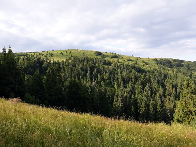
Brief Description: A difficult stage in the mountains, one of the most difficult on the entire trail. You will enjoy some stunning views and paths in Volovské Vrchy mountain range, but you will also have to cross a few fallen trees, and watch carefully for the trail marks to avoid getting lost (or you can download the GPS and stay on the safe side :)). Start early if you want to reach Spa Štós in the afternoon…
On your way you will pass two mountain lodges where you can eat and drink, Lajoska and Erika (km 5 and km 15). The second one was renovated recently, but you’ll pay the price for the modern looks. Lajoska has much better vibe, but the food options are really basic.
The trail is up and down virtually all day long, with minimum asphalt. Once in Štós, search building “Komporday”, where you can eat and also book your accommodation for the night.
Stage 8 – From Štós spa to mountain hut Volovec
- Distance: 31.9 kilometers
- Total Ascend/Descend: 1583 meters/1093 meters
- Technical difficulty: 3/5
- Orientation Difficulty: 4/5
- Terrain/Asphalt: 100%/0%
- Refreshment posts/Springs:
- Km 10.5, Pod Skorušinou, fresh water spring, N48.68933° E20.74146°
- Km 16, Fresh water spring, “Pod Pipitkou”, N48.68596° E20.67918°, you need to follow a footpath at your right hand and descend to the hunting hut (not directly visible from Pipitka), where you will find the spring.
- Km 32: Mountain hut Volovec, fresh water spring, the lodge is open only in summer months. You can have lunch or dinner inside (if open). When closed, you can still use the spring and a great camping ground in the surroundings of the hut.
- GPS File: Stage 8, Stos spa – Volovec mountain hut
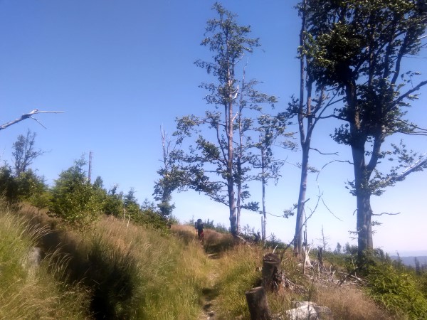
Brief Description: Another tough stage in the mountains. After initial ascend from Stos to Skorusina, you’ll follow the main ridge of Volovské Vrchy mountains, going up and down, crossing Osadník and Pipitka along the way.
The trail isn’t always obvious, and you should watch the mark on trees carefully. You may need to cross several fallen trees, and walk over certain patches of barren land. Summer heat can be almost unbearable at these places with scorching sun shining above you (if you’re not there in the storm, of course).
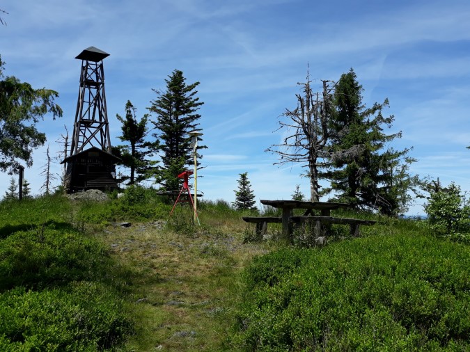
Once you reach Skalisko (km 31, 1284m), you’ll depart from the SNP trail, following green marks (white-green-white rectangles). Steep downhill in the forest will lead you to mountain hut Volovec, with a nice camping ground and fresh water in the neighborhood of the hut.
Stage 9: Mountain hut Volovec – Dobšinský Kopec
- Distance: 29 kilometers
- Total Ascend/Descend: 1065 meters/1335 meters
- Technical difficulty: 2/5
- Orientation Difficulty: 4/5
- Terrain/Asphalt: 95%/5%
- Refreshment posts/Springs:
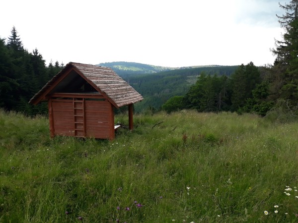
- Km 17, Shelter Galová, new wooden shelter built in 2020, directly on the SNP trail. Coffee/beer and some small snacks are typically stored inside, and the whole place is donation-based (you support the maintenance of the shelter with your donation). Offers a comfortable and dry sleeping place inside for up to 10 people.
- Km 18, Fresh water spring, N48.81021° E20.44301°. You have to leave the trail at “Pod Stromisom” crossroad, and follow wide gravel road to the left (no marks), which will take you to the hunting hut (emergency shelter for the night). The spring is located below the road, and you may spend some time trying to locate it. But it’s a copious spring and you’ll always find water in it.
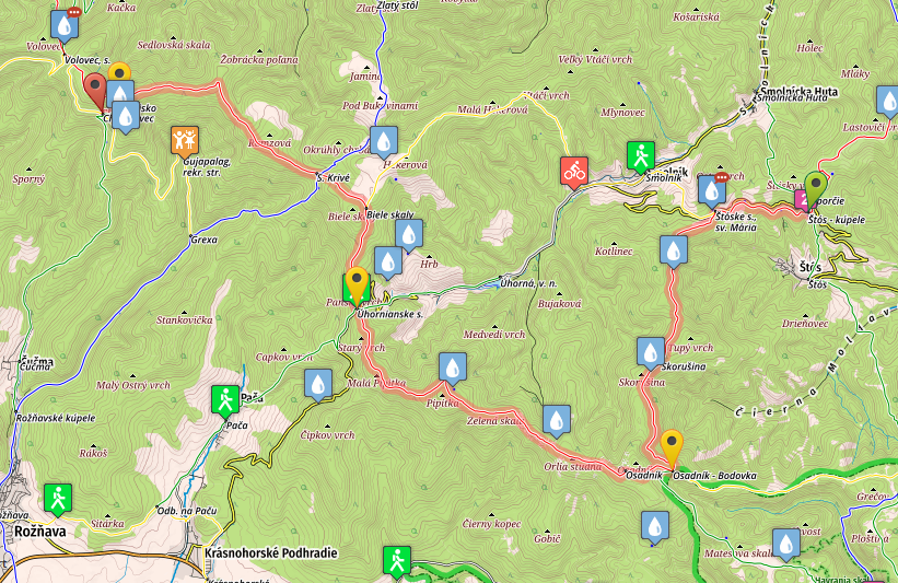
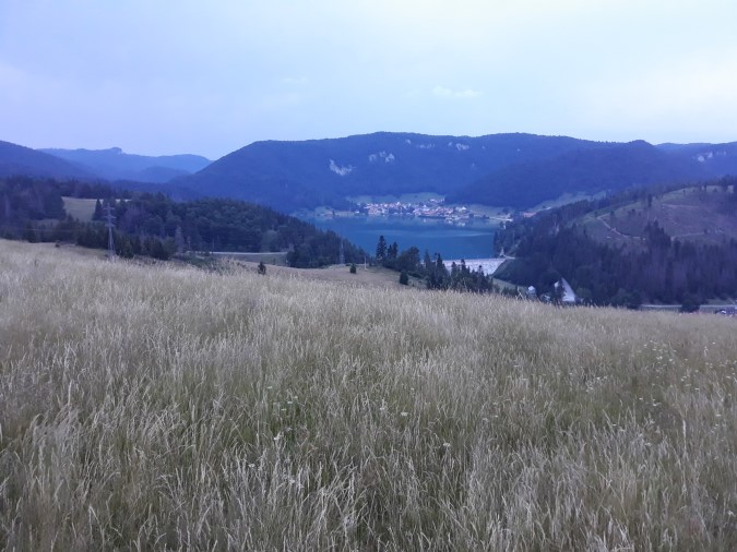
- Km 29, Dobšinský Kopec, Fresh water spring, N48.84595° E20.38101°. Once you reach the final point of the stage, you will come to a crossing of a big road. Once there, walk down the road in the direction of Dobsina (to your left). After one kilometer, on the left side of the road, you’ll find a spring of fresh water. If you intend to sleep inside, you’ll have to book accommodation near the dam Palcmanská Maša, two kilometers down the road in the opposite direction. Check the online map for directions, and accommodation page for some affordable options near the dam.
- GPS File: Stage 9, Volovec mountain hut – Dobsinsky Kopec
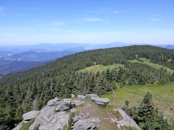
Brief Description: Final stage in Volovské Vrchy mountains. You will return from the hut, following the green marks uphill to Skalisko (1293m), and enjoy a beautiful morning view, observing mountain ranges in Slovakia, Poland, and stretching as far as to Romania if the visibility is good.
You will then return to the red marks, firstly following narrow footpaths (easy to make a wrong turn, so be careful, or check with the GPS when not sure), and later a gravel/wide road which will take you to Suľová Pass, and later to Pod Stromišom (km 18), where you should make a detour for water (check the refreshment posts info above).
From there you’ll continue following the wide gravel road, for another three kilometers, before finally leaving it for a beautiful grassy path, which will take you on several short but steep climbs and downhills. Finally you’ll reach Dobsinsky Kopec, where you can either camp (on the meadows above it, after you replenish your water reserves in the nearby spring), or walk down to Palcmanská Maša, and stay in one of the hotels/guest houses nearby the water dam. Check our accommodation section for some affordable options near the dam.
Stage 10, From Dobšinský Kopec to Telgart
- Distance: 21 kilometers
- Total Ascend/Descend: 800 meters/770 meters
- Technical difficulty: 2/5
- Orientation Difficulty: 2/5
- Terrain/Asphalt: 70%/30%
- Refreshment posts/Springs:
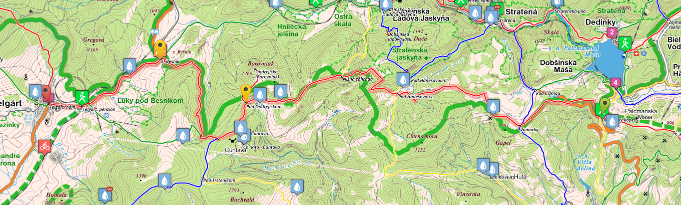
- Km 3.5, Fresh water spring “Voniarky”, N48.84924° E20.34021°. Copious spring near the hut and spacious arbor.
- Km 7, Fresh water spring “Pod Hanesovou 1”, N48.85541° E20.30931°. You need to leave the red marks and follow yellow marks, in direction of “Pod Hanesovou 2”. After about 150 meters turn right, in the direction of a small creek (there’s no obvious path). You will find a wonderful spring nearby the creek (the way to the spring isn’t particularly obvious, it may take you some time to find it).
- Km 18, Spring, Source of River Hron, N48.85851° E20.2155°, clearly marked and well maintained.
- Km 21, Telgart, restaurant, bars, grocery stores, various accommodation options.
- GPS File: Stage ten, Dobs. Kopec – Telgart
Brief Description: A beautiful day on the edge of Slovak Paradise National Park awaits you. Following a narrow path you’ll walk across colorful meadows, beaming with local flowers and butterflies. After a few kilometers you’ll join a wider road, which you will follow all the way up to Pod Hanesovou 1 (km 7), where you can get some water from a nearby spring.
Steep climb follows soon afterwards, and in no time you’ll reach a nice crest, 1,000 meters above sea level. Many small ups and downs follow as you pass both forests and virgin meadows, before eventually arriving near Cuntava hut (open only for reservations, but there’s a spring nearby), joining a wide gravel road.
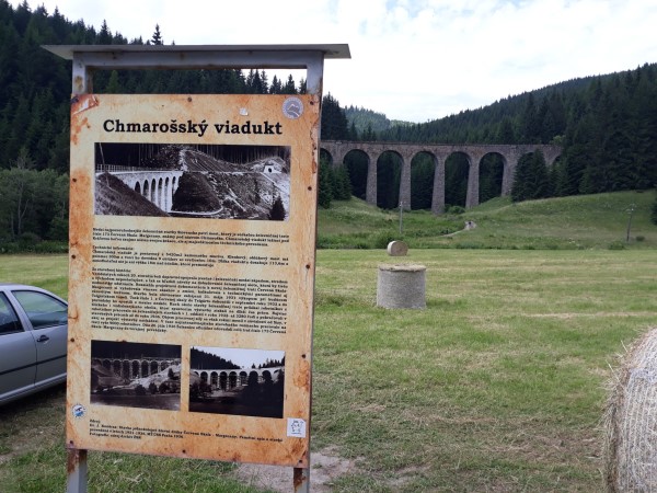
You’re more or less follow this road until Besnik pass, where you will join Road 66, a busy road with many trucks and cars. Walking on the side of a road you’ll soon see the source of river Hron (km 18) on your right, and a beautiful rail viaduct, before finally arriving in Telgart. Two more kilometers across the village and you’ll arrive in a small city center. Most of accommodation/catering facilities are located nearby…
For the next five stages of SNP trail (Trail of the Heroes of Slovak National Uprising, E8 Path in Slovakia), please continue here: SNP Trail, stages 11-15
* For the previous five stages (from Dukla to Kysak), go here: SNP Trail Part 1.