* You will find the previous stages on the following page: SNP Trail, Stages 15-20.
Disclaimer: Some links on this website may be affiliate links. That means that when you click them and make a purchase (for example booking some accommodation along the trail on Booking.com), I may earn a small commission, at no extra cost to you whatsoever. This small income helps me to keep this website running, paying for hosting and domain renewal, and also to keep answering the questions of fellow long-distance hikers by email that keep coming regularly, week after week. Thank you :).
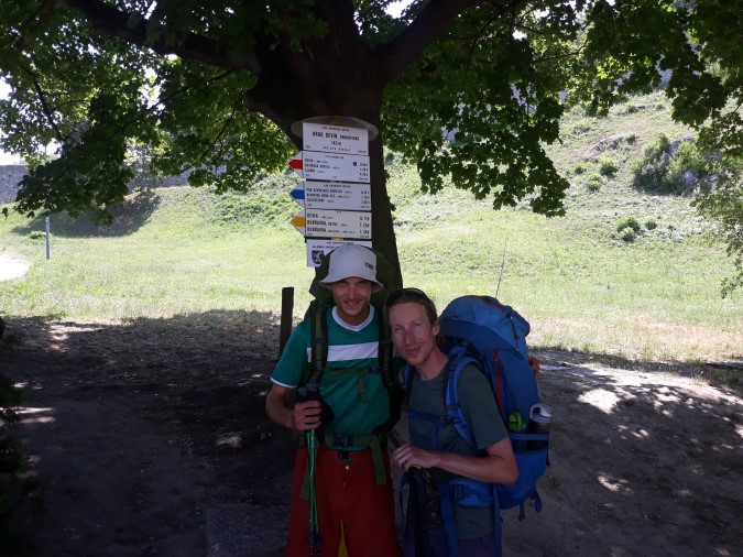
Table of Contents
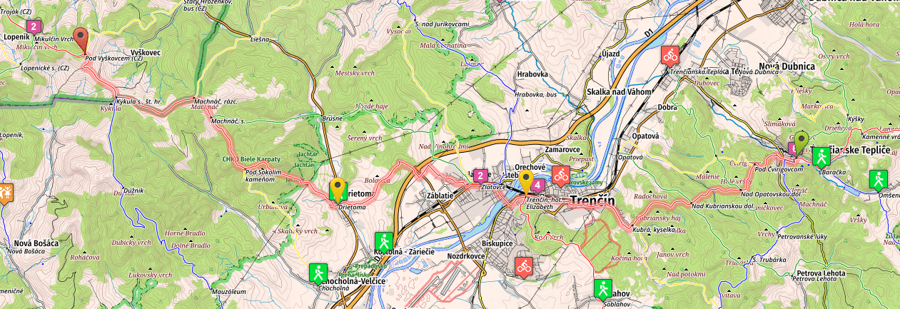
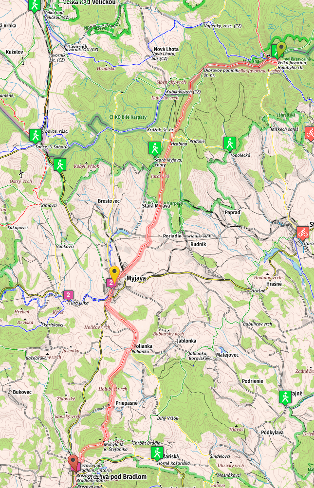
Stage 21, From Trenčianske Teplice to Vyškovec
- Distance: 35 kilometers
- Total Ascend/Descend: 1540 meters/1050 meters
- Technical difficulty: 1/5
- Orientation Difficulty: 2/5
- Terrain/Asphalt: 66%/33%
- Refreshment posts/Springs:
- Km 2, Fresh water spring “Pod Čvirigovcom”, N48.90569° E18.15619°, directly on the trail.
- Km 8.5, Kubrica, mineral water spring and a small pension, offering various fast food snacks & drinks
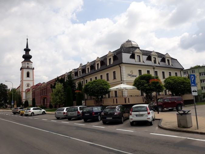
- Km 13, Trenčín, the 3rd biggest city on the entire trail, all services. See accommodation options for all budgets here.
- Km 19, Záblatská Kyselka, another mineral water spring, camping ground, small shelter
- Km 22, Drietomá, tavern, grocery store
- Km 25, Fresh water spring “Pod Sokolím Kameňom”, N48.90547° E17.912°, directly on the trail
- Km 35, Vyškovec, mountain hut, restaurant and accommodation options.
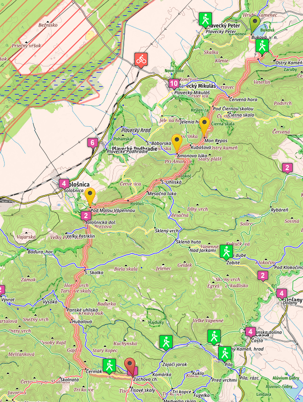
- GPS File: Stage 21, Teplice – Vyskovec
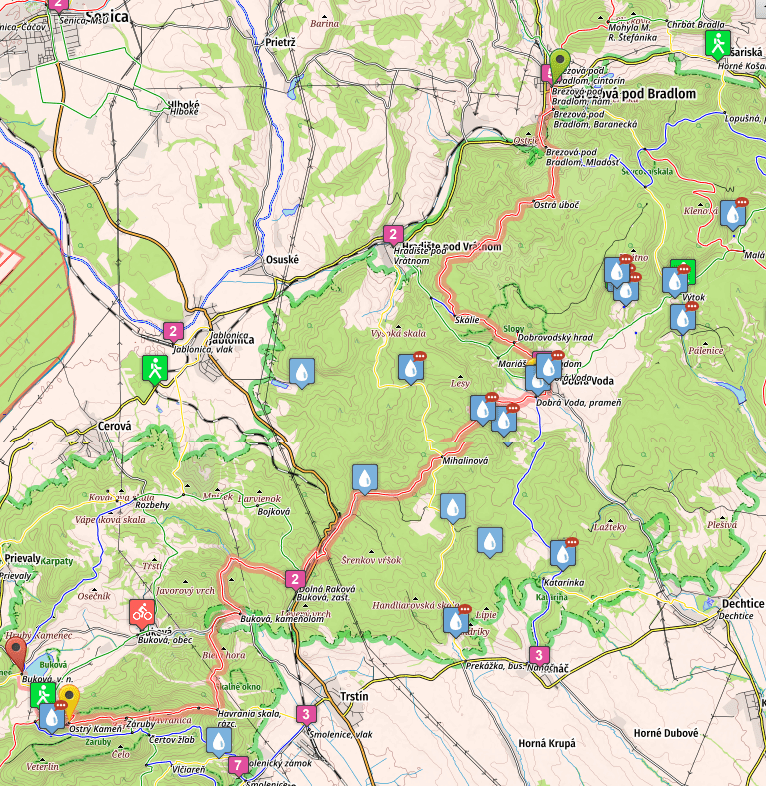
Brief Description: Contrary to the previous stage, this one is easier as it looks. Passing through the center of Tr. Teplice, you’ll start a series of short climbs and downhills in Strážov mountains, eventually reaching Kubrica (km 8.5), where you can have a snack in a fast food stand, or refill your bottles with tasty mineral water.
From then on the trail is almost flat, and soon enough you’ll find yourself in the center of Trenčín (km 13). If you are tired, if you need to buy anything special (gas bomb, hiking gear, clothes), or basically if you do not rush and want to make a short day, this is another great place to do so.
Trenčín is a big city and you’ll find all shops you can imagine, all kinds of restaurants and bars… Back to the trail, asphalt roads, completely flat, and later a mud track among the fields, will take you to Záblatská Kyselka (km 19), where you can take water and also stay in a small shelter.
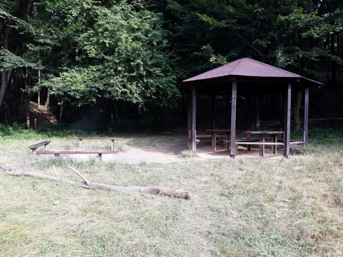
After crossing a small hill you’ll reach Drietoma (km 22), another spot that offers options for basic shopping or drinking in a tavern. From Drietoma you’ll finally start some serious climb up to Sokolí Kameň, where you will find a bench, fireplace, and a place to pitch one tent… You will pass a spring on your way to the peak.
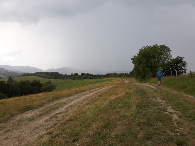
After Sokolí Kameň you’ll climb again, but just a bit, to Machnáč peak (km 28, 771m), and from there follow a wide and obvious grassy ridge, until reaching Kykula, and for a short time crossing borders to Czech Republic (don’t worry though, both countries are in Schengen zone, and you do not need visa or showing your papers to anyone; simply continue walking).
Mountain hut Vyškovec is located two kilometers further–the route to the hut us well marked…
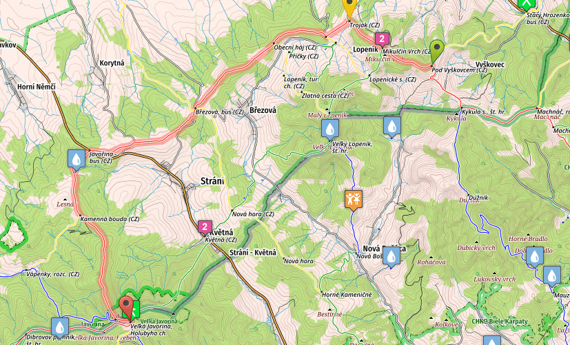
Stage 22, From Vyškovec to Veľká Javorina (mountain hut)
- Distance: 24 kilometers
- Total Ascend/Descend: 775 meters/640 meters
- Technical difficulty: 1/5
- Orientation Difficulty: 1/5
- Terrain/Asphalt: 66%/33%
- Refreshment posts/Springs:
- Km 2, Recreational center Mikulčin Vrch. Two mountain lodges, one guest house. Accommodation and dining options, open all year long.
- Km 16, Fresh water spring, N48.90694° E17.65436° , on your left hand, there are red marks pointing to the spring.
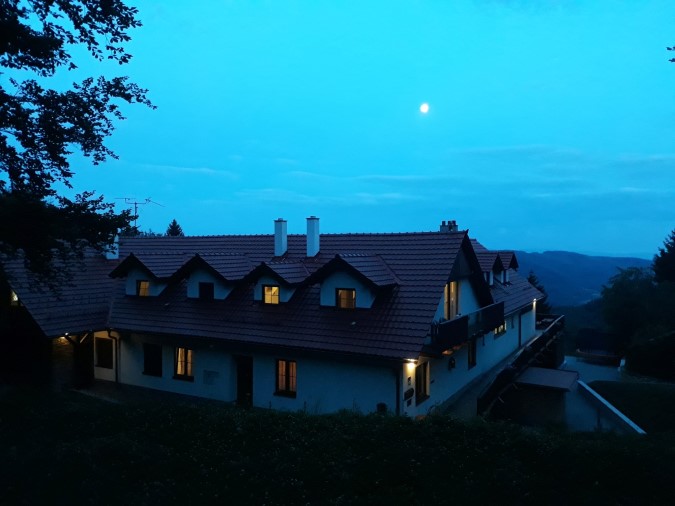
- Km 24, Veľká Javorina, Holubyho Chata – mountain lodge, restaurant and a possibility to sleep in the hut. The restaurant has been renovated recently and is in excellent condition (though healthy food lovers won’t be particularly pleased with the menu). The rooms are rather old and quite pricey, however, the next bed option to get a room is thirteen kilometers away.
- GPS File:Stage 22, Vyskovec – V. Javorina
Brief Description: This is perhaps the easiest day on the trail. You’ll start with a five km walk on a quiet country road, passing Mikulčin Vrch resort at km 2 (you can stop here for food or wellness, and you can even sleep here in one of the huts).
After leaving the road you’ll follow some mild ascends and descends, with obvious trail, passing one spring along the way (km 16). The only real climb start at km 20, when you will walk up to the top of Veľká Javorina (970m), the highest peak of White Carpathians.
Walking steeply down for another 800 meters, you’ll reach the mountain lodge, where you can eat and also sleep. Be aware that the latest arrival to the lodge Holubyho Chata is at 8pm!
Stage 23, From V. Javorina to Brezova pod Bradlom
- Distance: 31.7 kilometers
- Total Ascend/Descend: 680 meters/1300 meters
- Technical difficulty: 1/5
- Orientation Difficulty: 2/5
- Terrain/Asphalt: 66%/33%
- Refreshment posts/Springs:
- Km 13, Ski center Stará Myjava, restaurant, guest house. Guest house is directly on the trail, but ask locals for directions to the restaurant.
- Km 18, Myjava, hotels, restaurants, shops, all services.
- Km 28, Cairn of M. R. Štefánik, the small, good, and expensive restaurant below the cairn is in reconstruction now, but you can get water and some very basic snacks in a tourist information point nearby the cairn.
- Km 31.7, Brezová pod Bradlom, accommodation, restaurants, taverns, shops.
- GPS File: Stage 23, V. Javorina – Brezova
Brief Description: After climbing briefly to the top of Veľká Javorina, you’ll start a pleasant and gradual descent, which is enlivened with a couple of short undemanding climbs.
With very little effort you’ll reach Stará Myjava ski resort (km 13) and after walking on the road for five more kilometers you’ll enter the city center of Myjava (km 18), where you can find all services.
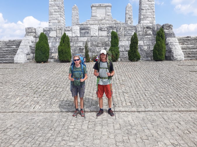
Switching between quiet country roads and trails, traversing the beautiful country full of scattered settlements (called “kopanice” in Slovak language), you’ll eventually climb sharply to a monumental Cairn of M.R. Štefánik (km 28), a place where you will always meet some hikers and tourists (the place is accessible by car).
Steep descent through the forest will take you on the edge of Brezová pod Bradlom. Walking a bit further you’ll reach the small city center, where you can have a drink, buy groceries, or stay in one of the guest houses (check accommodation section for more information).
Stage 24, From Brezová pod Bradlom to Buková camping (water dam)
- Distance: 37.5 kilometers
- Total Ascend/Descend: 1390 meters/1370 meters
- Technical difficulty: 4/5
- Orientation Difficulty: 4/5
- Terrain/Asphalt: 80%/20%
- Refreshment posts/Springs:
- Km 13, Dobrá Voda, restaurant, grocery store, guest house. There is an amazing fresh water spring directly in the village, ask locals for location or go here: N48.59735° E17.53843°.
- Km 19, Fresh water spring, N48.57418° E17.47412°.
- Km 37.5, Dam Buková, camping ground, fast food stalls (with good selection of dishes), possibility of sleeping inside. You need to leave the red marks in “Brezinky” crossroad, and follow yellow marks for about one kilometer to reach the camping ground near Buková dam.
- GPS File: Stage 24, Brezova – Bukova
Brief Description: Your legs should be rested after few easy days (relatively easy at least), so it is time to give them some extra millage. Early start is highly recommended for this stage, especially if you want to arrive at Buková dam early and take a swim…
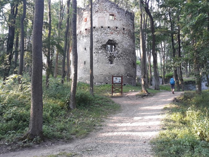
First thirteen kilometers are quite easy, following wide tracks, sometimes even asphalt roads, crossing a nice plateau in the forests of Little Carpathians. At km 11 you can make a small detour to visit the Castle Dobrá Voda, a place which is definitely worthy of a short visit at least (you can also camp here for the night, but be careful to leave before 7:30 the next morning, since conservation workers often come to the site and they do not like to see people camping near the castle).
In Dobrá Voda (km 13) you should take a lot of water from an excellent spring right in the center of the village (ask locals for the way to the spring, it’s right near the creek that flows through the village).
Next 12 kilometers are relatively easy, with some small descents and climbs, nothing that will shake with your composure. Some sharp turns aren’t obvious, however, pay special attention to red marks to avoid getting lost.
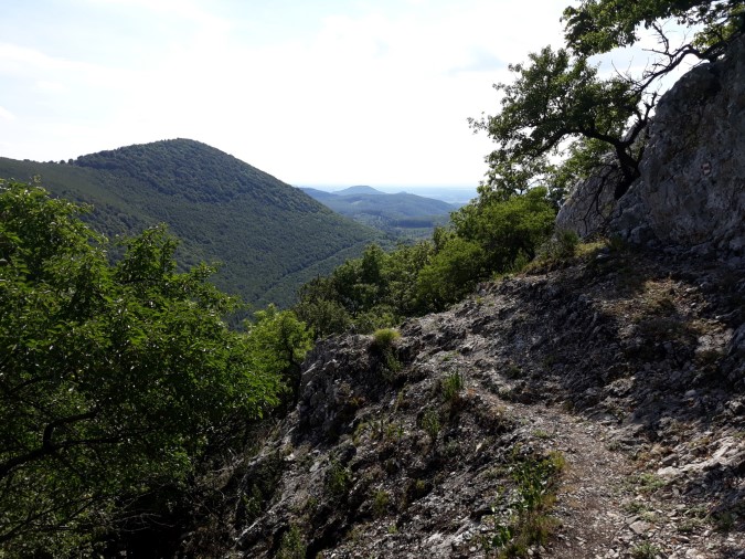
The real challenge of the day starts at Buková Kameňolom crossroad (km 26, 245m). You will climb steeply all the way up to Záruby (km 32.5, 768m). The ascend is extremely technical at some point, and hikers who are afraid of heights, or feel tired ,may struggle greatly to navigate it, especially in bad weather (when the rocks are slippery).
The ridge and the scenery is a great reward, however, as Záruby are widely considered as one of the most beautiful peaks on the entire trail… Long descent follows, firstly technical and then relaxing, until you finally reach Brezinky (km 36, 350m), where you will take the yellow marks and after one kilometer reach the Buková dam camping ground, where you can eat, sleep, replenish your water reserves…
Stage 25, From Buková to Zochova Chata (hotel)
- Distance: 30 kilometers
- Total Ascend/Descend: 1390 meters/1220 meters
- Technical difficulty: 3/5
- Orientation Difficulty: 2/5
- Terrain/Asphalt: 90%/10%
- Refreshment posts/Springs:
- Km 7.5, Spring “Monsrepos”, N48.48814° E17.32534°, not the best but can be used in emergency cases (filtrating water is recommended at this particular spring)
- Km 9.5, Fresh water spring near Amonova Lúka, N48.47876° E17.30756° follow the marks that will take you to the spring, about 200 meters off the trail. Not very abundant in hot summer months, but you should always find water, at least dripping.
- Km 15, Fresh water spring “Pod Malou Vápennou”, N48.45741° E17.24699°, 200 meters detour, follow green trail marks downhill, this is the best spring on today’s hike, worth making a detour. If you need to buy groceries, you can continue following the green marks all the way to Sološnica village (4 km total detour, there and back), where you will find shops and a restaurant.
- Km 23, Fresh water spring “Pod Hubalovou”, N48.40666° E17.23566°
- Km 26.5, Spring “Modranská Baba”, N48.3844° E17.24754°
- Km 30, Zochova Chata, four star hotel with excellent restaurant and wellness. Possibility to camp near the hotel, if you are on budget, consult the staff. You can also stay at some other properties nearby, have a look at our accommodation page for more information.
- GPS File: Stage 25, Bukova – Zochova Chata
Brief Description: The first fifteen kilometers of your day is mostly uphill, but it is not very steep, and unless rainy, the first 13 kilometers make for a pleasant walk (wide trails, well marked).
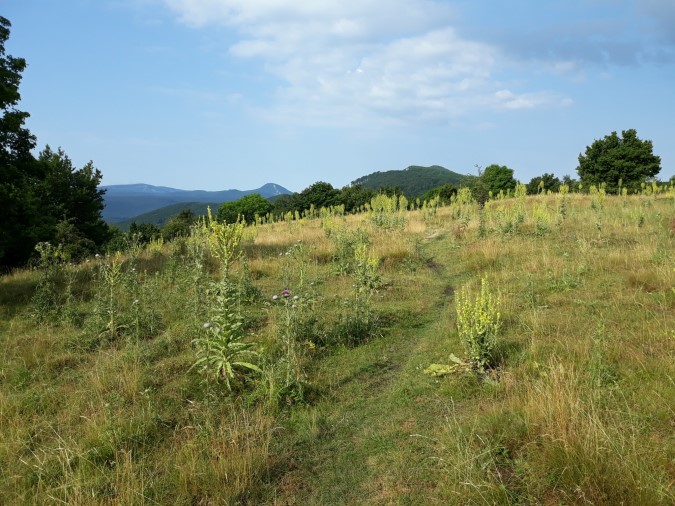
From Mesačná Lúka (km 13, 670m) the trail changes completely. After some beautiful sections with moon-like scenery, you’ll climb steeply over slippery rocks to Vapenná peak (km 15, 752m).
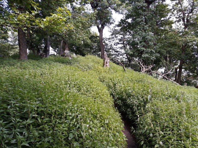
The trail has a tendency to overgrow with stinging nettle in summer months, which makes for a tricky passage… Once on the top, enjoy a wonderful scenery all around you. You’ll find an emergency camping ground barely 100 meters after crossing Vápenná. However, if the weather is stormy, you shouldn’t camp here (it’s too risky).
Sharp descend will take you to “Pod Malou Vápennou” crossroad (km 17, 375m). From here you can make a detour to Sološnica village to buy groceries (see refreshment posts above), or at least make a small detour to the wonderful fresh water spring…
Back on the red marks, you’ll descend another 100 meters before climbing to Skalka pass (km 21, 525m). From there the trail isn’t particularly interesting. You’ll pass some shelters and springs, until finally arriving at Čermák crossroad (km 26.5), where you will follow yellow marks all the way to Zochova Chata hotel.
Stage 26, From Zochova Chata to Biely Kríž
- Distance: 26 kilometers
- Total Ascend/Descend: 915 meters/860 meters
- Technical difficulty: 2/5
- Orientation Difficulty: 1/5
- Terrain/Asphalt: 95%/5%
- Refreshment posts/Springs:
- Km 2.7, Spring “Modranská Baba”, N48.3844° E17.24754°
- Km 10.5, Pezinská Baba, restaurant and fast food stands, accommodation options
- Km 26, Biely Kríž, restaurants, new guest house, camping ground nearby.
- GPS File: Stage 26, Zochova Chata – Biely Kriz
Brief Description: Getting ever closer to Bratislava (capital of Slovakia), the number of hikers and bikers on the trail intensifies. The paths are wide and well-trodden, and you don’t need to be afraid of getting lost.
You’ll start climbing from Zochova Chata, passing two interesting hills (Skalnatá, km 4.5, 704m, and Čertov Kopec, km6, 725m) on your way to the pass Pezinská Baba (km 10,5, 535m), where you can eat or even stay for the night (check the accommodation page for more information).
Besides a few steep and one particularly technical climb, you’ll enjoy a pleasant and easy hike, far from wilderness experienced on other parts of SNP Trail. Few small climbs and downhills and you find yourself at Biely Kríž crossroad, a locality which is very popular by the locals. Enjoy a good meal and prepare for the last day of your hike…
Stage 27, From Biely Kríž to Devín Castle
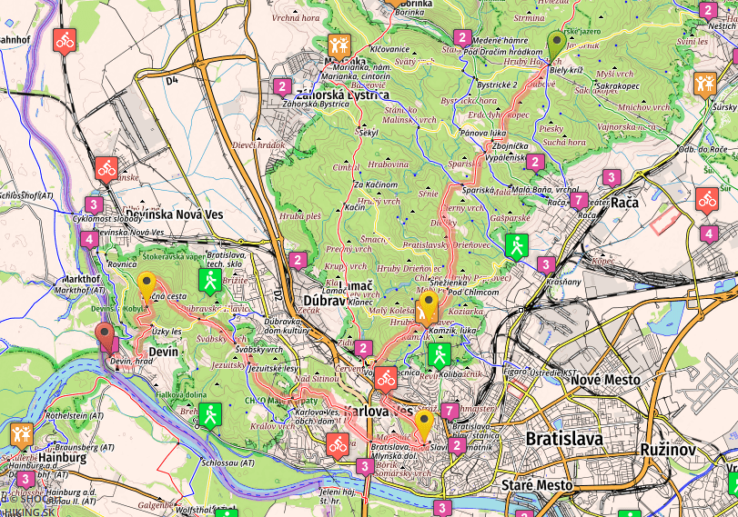
- Distance: 31 kilometers
- Total Ascend/Descend: 975 meters/1330 meters
- Technical difficulty: 2/5
- Orientation Difficulty: 4/5
- Terrain/Asphalt: 25%/75%
- Refreshment posts/Springs:
- Km 2.5, Spring, N48.23363° E17.12664°
- Km 4,5, Spring “Jarošova Studnička”, N48.22037° E17.11606°
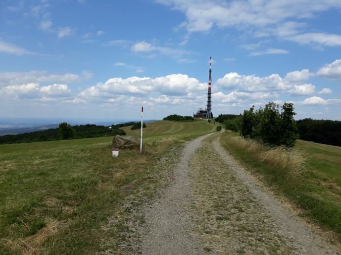
- Km 11, Kamzík, TV tower, fast food stands, luxury restaurant, camping ground nearby (1km after Kamzík)
- Km 18, Mlynská Dolina, grocery store, shops, restaurants
- Km 22, Karlova Ves, shop and taverns, ask locals for exact location
- Km 31, Castle Devín, the end of the trail, accommodation and several restaurants.
- GPS File: Stage 27, Biely Kríž – Devín
Brief Description: Everything has to end. On some day, at some point. SNP Trail is no exceptions.
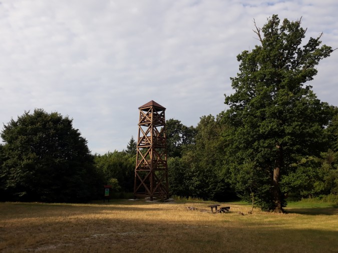
The last day is arguably the most boring one (unless you enjoy walking on the road and in the suburbs of a big city). However, it still offers some interesting places (Kamzík, Devínska Kobyla), and paved roads make a good walking terrain for mind travels…
The first eleven kilometers from Biely Kríž to Kamzík (km 11) are almost entirely on asphalt. But it’s a quiet road, cars are not allowed, and you’ll meet many hikers and bikers on your way. One km after Kamzík you arrive at a nice meadow with a lookout tower, small shelter and fireplace. This is practically the last place where you can camp for the night.
Another kilometer after the meadow you’ll enter the city of Bratislava, and will spend the next nine kilometers walking down the streets, following the red marks. The marks are not always obvious, so watch carefully or use GPS. It is often easier to get lost in the city than it is in the wilderness.
Just like in any other city, you’ll walk past some taverns and shops, especially in Mlynská Dolina (km 18).
After overcoming some short ascends in the forest and some stairs in the city, descending to Karlova Ves (km 22), you’ll leave the paved roads for one last time, walking up to the last interesting peak on the trail, Devínska Kobyla (km 27, 490m). A technical descent will take you down to the village of Devín, and after a short walk down the local streets you’ll arrive at the crossroad “Hrad Devín” (km 31, 145m), which is the end of E8 trail in Slovakia…
Enjoy the moment. You have just finished a traverse of our beautiful country, from East to West, covering almost 800 kilometers and more than 30,000 vertical meters.
And though there’s neither a temple (Like in Santiago or Jerusalem), nor a base camp of a famous peak, or the top of the peak itself (one you’d reach on a long trek in Nepal), Devín Castle is definitely not an anticlimax :)….
Life’s a journey, not a destination…
If you want to continue your trail to Austria, or look for the best way to travel back home, check our travel info page. If you need any additional information, or just want tot say hello, you can contact me. Thank you, see you on the trails!
Matej